IMAGES TAKEN NEAR TO
Macinnes Drive, MOTHERWELL, ML1 5TY

Introduction

This page details the photographs taken nearby to Macinnes Drive, ML1 5TY by members of the Geograph project.

The Geograph project started in 2005 with the aim of publishing, organising and preserving representative images for every square kilometre of Great Britain, Ireland and the Isle of Man.

There are currently over 7.5m images from over14,400 individuals and you can help contribute to the project by visiting https://www.geograph.org.uk

Image Map


Images are licensed for reuse under creativecommons.org/licenses/by-sa/2.0
Notes
  • Clicking on the map will re-center to the selected point.
  • The higher the marker number, the further away the image location is from the centre of the postcode.

Image Listing (8 Images Found)

Images are licensed for reuse under creativecommons.org/licenses/by-sa/2.0
Image
Details
Distance
1
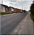
High Street Newarthill
The village has expanded along the B7066
Image: © Jim Smillie Taken: 19 Apr 2021
0.04 miles
2
New houses at Pickerstonhill, Newarthill
On the main road towards Newhouse.
Image: © wrobison Taken: 3 Mar 2021
0.05 miles
3
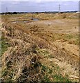
Former opencast
Large area or waste ground. A glass recycling plant occupies part of the site
Image: © Jim Smillie Taken: 19 Apr 2021
0.17 miles
4
Puddles and Pylons
Typically grim Lanarkshire scenery. Line of pylons crossing old mine workings.
Image: © Chris Upson Taken: 3 Sep 2006
0.19 miles
5
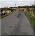
Biggar Road
A narrow road, the name suggests that once it was more important.
Image: © Richard Webb Taken: 1 Apr 2010
0.20 miles
6
A wet field beside the Biggar Road
Grassland sloping down to the Legbrannock Burn. Grazed by sheep.
Image: © Richard Webb Taken: 1 Apr 2010
0.21 miles
7
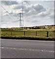
Electricity pylon
A number of others are visible leading to a sub-station
Image: © Jim Smillie Taken: 19 Apr 2021
0.21 miles
8
Bridge on Biggar Road
Crossing Legbrannock Burn
Image: © Jim Smillie Taken: 19 Apr 2021
0.24 miles