IMAGES TAKEN NEAR TO
Carey Gardens, MOTHERWELL, ML1 5RS

Introduction

This page details the photographs taken nearby to Carey Gardens, ML1 5RS by members of the Geograph project.

The Geograph project started in 2005 with the aim of publishing, organising and preserving representative images for every square kilometre of Great Britain, Ireland and the Isle of Man.

There are currently over 7.5m images from over14,400 individuals and you can help contribute to the project by visiting https://www.geograph.org.uk

Image Map


Images are licensed for reuse under creativecommons.org/licenses/by-sa/2.0
Notes
  • Clicking on the map will re-center to the selected point.
  • The higher the marker number, the further away the image location is from the centre of the postcode.

Image Listing (22 Images Found)

Images are licensed for reuse under creativecommons.org/licenses/by-sa/2.0
  • ...
Image
Details
Distance
1
Station Bar, Cleland
This public house, in Main Street, is halfway between the two stations that have served Cleland. The present station, a few hundred yards to the left, on the Edinburgh - Shotts - Glasgow line, was opened in 1869 as Bellside, was renamed Omoa in 1879 and only became Cleland in 1941. A similar distance to the right was an earlier Cleland station, opened in 1867 on a line that meandered round to Morningside and Wishaw. It was closed briefly during the First World War and finally closed to passengers in 1930.
Image: © A-M-Jervis Taken: 14 Jul 2007
0.02 miles
2
Station Bar, Cleland
On Main Street - appears to be closed.
Image: © JThomas Taken: 17 Sep 2021
0.04 miles
3
Garage on Main Street, Cleland
Image: © JThomas Taken: 17 Sep 2021
0.05 miles
4
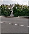
Cleland War Memorial
Erected in 1934 after public subscription, to the memory of the men of Cleland and District who fell in the Great War 1914–1918.
Image: © Jim Smillie Taken: 19 Apr 2021
0.15 miles
5
Cleland Railway Station
Image: © Chris Upson Taken: 3 Sep 2006
0.15 miles
6
Housing Development
On the site of Cleland Hospital
Image: © Jim Smillie Taken: 19 Apr 2021
0.15 miles
7
Station Road, Cleland
The station in question closed in 1930, and would have been behind the white houses to the right. See also Image
Image: © Nigel Thompson Taken: 8 Jun 2019
0.16 miles
8
Demolition at Cleland Hospital
Image: © Ian Paterson Taken: 20 Feb 2008
0.16 miles
9
Fruit Corner, Cleland
Not much for sale on Sunday
Image: © Chris Upson Taken: 3 Sep 2006
0.17 miles
10
Delaney's Bar & Lounge, Cleland
On Main Street.
Image: © JThomas Taken: 17 Sep 2021
0.18 miles
  • ...