IMAGES TAKEN NEAR TO
Bellside Road, MOTHERWELL, ML1 5NP

Introduction

This page details the photographs taken nearby to Bellside Road, ML1 5NP by members of the Geograph project.

The Geograph project started in 2005 with the aim of publishing, organising and preserving representative images for every square kilometre of Great Britain, Ireland and the Isle of Man.

There are currently over 7.5m images from over14,400 individuals and you can help contribute to the project by visiting https://www.geograph.org.uk

Image Map


Images are licensed for reuse under creativecommons.org/licenses/by-sa/2.0
Notes
  • Clicking on the map will re-center to the selected point.
  • The higher the marker number, the further away the image location is from the centre of the postcode.

Image Listing (17 Images Found)

Images are licensed for reuse under creativecommons.org/licenses/by-sa/2.0
Image
Details
Distance
1
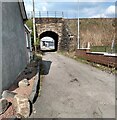
Access under rail bridge
Into an area that was once bounded on three sides by railways
Image: © Jim Smillie Taken: 19 Apr 2021
0.02 miles
2
Cleland Viaduct
Image: © Chris Upson Taken: 3 Sep 2006
0.02 miles
3
Viaduct at Cleland
The railway line above leads to Cleland Station.
Image: © Ian Paterson Taken: 20 Feb 2008
0.03 miles
4
Cleland Parish Church
Image: © Ian Paterson Taken: 20 Feb 2008
0.05 miles
5
Cleland Viaduct
Takes the Shotts Line, still open, over a burn cutting deeply down to the level of the South Calder Water and Clyde as well as the trackbed of the Airdrie and Newhouse Line.
Image: © Richard Webb Taken: 11 Feb 2011
0.06 miles
6
Cleland Railway Station
Viewed from the Biggar Road bridge.
Image: © G Laird Taken: 8 Sep 2010
0.11 miles
7
Cleland Railway Station
On the line from Glasgow Central to Edinburgh Waverley via Shotts. View towards Hartwood and Edinburgh.
Image: © JThomas Taken: 17 Sep 2021
0.11 miles
8
Cleland Viaduct
Image: © Richard Webb Taken: 11 Feb 2011
0.12 miles
9
Housing Development
On the site of Cleland Hospital
Image: © Jim Smillie Taken: 19 Apr 2021
0.13 miles
10
Cleland railway station, Lanarkshire, 2013
Opened in 1869 as 'Bellside' by the Caledonian Railway on the line from Glasgow to Edinburgh via Shotts, this station name was changed to 'Omoa' between 1879 and 1941. View west towards Carfin and Glasgow, some 6 years before the railway line was electrified. See Image for a 2019 view from the same camera position. The main station building used to be on the left.
Image: © Nigel Thompson Taken: 7 Oct 2013
0.13 miles