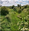
IMAGES TAKEN NEAR TO
Wilsons Road, MOTHERWELL, ML1 5NA

Introduction

This page details the photographs taken nearby to Wilsons Road, ML1 5NA by members of the Geograph project.

The Geograph project started in 2005 with the aim of publishing, organising and preserving representative images for every square kilometre of Great Britain, Ireland and the Isle of Man.

There are currently over 7.5m images from over14,400 individuals and you can help contribute to the project by visiting https://www.geograph.org.uk

Image Map


Images are licensed for reuse under creativecommons.org/licenses/by-sa/2.0
Notes
  • Clicking on the map will re-center to the selected point.
  • The higher the marker number, the further away the image location is from the centre of the postcode.

Image Listing (14 Images Found)

Images are licensed for reuse under creativecommons.org/licenses/by-sa/2.0
Image
Details
Distance
1
Hareshaw
View northward - the village is mostly ribbon development along three roads.
Image: © Richard Webb Taken: 20 Mar 2009
0.03 miles
2
Open space Wilson's Road
Up till the early 1970's there were prefabs on this site.
Image: © Jim Smillie Taken: 20 May 2009
0.05 miles
3
Telephone box, Hareshaw
Image: © Richard Webb Taken: 20 Mar 2009
0.09 miles
4
Hareshaw
A small public garden in the centre of Hareshaw.
Image: © Richard Webb Taken: 20 Mar 2009
0.14 miles
5
Pink Cottage in Hareshaw Village
With conspicuous monkey puzzle tree.
Image: © Chris Upson Taken: 3 Sep 2006
0.14 miles
6
Corner of Hareshaw Road
One of the older houses in Hareshaw a small settlement which has expanded in the last 20 to 30 years.
Image: © Jim Smillie Taken: 20 May 2009
0.16 miles
7
Tillan Burn
Piped under road here.
Image: © Jim Smillie Taken: 7 May 2009
0.17 miles
8
Linrigg Road
View downhill to the bridge over the Tillan Burn. It was possible to cycle again at the bridge, Linrigg Road being rendered effectively impassable by hedge trimmings.
Image: © Richard Webb Taken: 20 Mar 2009
0.17 miles
9
Entering Hareshaw from the south-east
At the point where the minor road crosses a bridge over a dismantled railway line.
Image: © G Laird Taken: 15 Feb 2011
0.19 miles
10
Old railway from bridge
This was a mineral line serving the local pits Compare Image
Image: © Jim Smillie Taken: 7 Jul 2021
0.20 miles