IMAGES TAKEN NEAR TO
Swinstie Road, MOTHERWELL, ML1 5LN

Introduction

This page details the photographs taken nearby to Swinstie Road, ML1 5LN by members of the Geograph project.

The Geograph project started in 2005 with the aim of publishing, organising and preserving representative images for every square kilometre of Great Britain, Ireland and the Isle of Man.

There are currently over 7.5m images from over14,400 individuals and you can help contribute to the project by visiting https://www.geograph.org.uk

Image Map


Images are licensed for reuse under creativecommons.org/licenses/by-sa/2.0
Notes
  • Clicking on the map will re-center to the selected point.
  • The higher the marker number, the further away the image location is from the centre of the postcode.

Image Listing (6 Images Found)

Images are licensed for reuse under creativecommons.org/licenses/by-sa/2.0
Image
Details
Distance
1
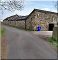
Swinstie Farm Steading
Appears to have been recently renovated
Image: © Jim Smillie Taken: 19 Apr 2021
0.01 miles
2
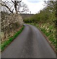
Swinstie Road
Roadside hedge coming into bloom
Image: © Jim Smillie Taken: 19 Apr 2021
0.09 miles
3
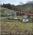
Sewage pipe: Swinstie Road
Appears to have been recently upgraded
Image: © Jim Smillie Taken: 19 Apr 2021
0.14 miles
4
Sewer pipe
A pipe crossing the South Calder Water in woodland.
Image: © Richard Webb Taken: 11 Feb 2011
0.15 miles
5
Overflowing sewer
An unsightly mess around this hole without an inspection cover. The sewer pipe below must have overflowed during recent heavy rainfall.
Image: © Richard Webb Taken: 11 Feb 2011
0.17 miles
6
Coltness Bridge
Looking towards Coltness along the Cleland to Coltness Road. The car in the picture is crossing the Coltness Bridge which spans the South Calder Water.
Image: © G Laird Taken: 12 Apr 2009
0.25 miles