
IMAGES TAKEN NEAR TO
Biggar Road, MOTHERWELL, ML1 5FA
Introduction
This page details the photographs taken nearby to Biggar Road, ML1 5FA by members of the Geograph project.
The Geograph project started in 2005 with the aim of publishing, organising and preserving representative images for every square kilometre of Great Britain, Ireland and the Isle of Man.

There are currently over 7.5m images from over14,400 individuals and you can help contribute to the project by visiting https://www.geograph.org.uk
Image Map
Images are licensed for reuse under creativecommons.org/licenses/by-sa/2.0
Notes
- Clicking on the map will re-center to the selected point.
- The higher the marker number, the further away the image location is from the centre of the postcode.
Image Listing (4 Images Found)
Images are licensed for reuse under creativecommons.org/licenses/by-sa/2.0
Image
Details
Distance
1
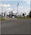
Argent Energy Plant
Producing bio-fuels from waste fats and oils
Image: © Jim Smillie
Taken: 19 Apr 2021
0.04 miles
2

Argent Energy Biodiesel Plant
Argent Energy operates the UK's first large-scale biodiesel plant. This plant produced its first batch of biodiesel in March 2005 and is now capable of producing nearly 50 million litres of biodiesel per year.
http://www.argentenergy.com/
Image: © Chris Upson
Taken: 3 Sep 2006
0.05 miles
3
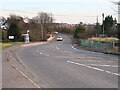
Biggarford Bridge
The bridge crosses the Tillan Burn. A dangerous curve on the far side of the bridge was the scene of many accidents in the early 1920s and in 1924 the road was re-aligned and a new bridge was erected by the County Council. The work was funded by a grant from the Unemployment Grants Committee.
Image: © wrobison
Taken: 1 Mar 2021
0.07 miles
4
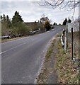
Biggarford Bridge
Came across the name Biggarford doing family tree research.
A cousin 3 times removed born 1861 who ended up in British Columbia
Image: © Jim Smillie
Taken: 19 Apr 2021
0.08 miles