1
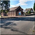
Road closure, Chapelknowe Road
Road closures are very common now, and great care must be taken when planning journeys and journey times. Often diversions are lengthy and a good knowledge of the road network can save time over the official routes. This closure was easily passed on a bike.
Image: © Richard Webb
Taken: 24 Oct 2011
0.02 miles
2
Frosty day in Carfin
Frosty day before the snow came down.
Picture is trees behind the church at Carfin cross
Image: © dan m
Taken: 13 Dec 2009
0.05 miles
3
Former church hall
Now operating as 'The Dojo' offering karate and other 'Wellness' classes
Image: © Jim Smillie
Taken: 8 Sep 2021
0.06 miles
4
Land awaiting development, Carfin
On the edge of the lost Ravenscraig Steel Works land is being developed for housing.
Image: © Richard Webb
Taken: 24 Oct 2011
0.07 miles
5
Postbox on Motherwell Road, Carfin
Postbox No. ML1 24.
Image: © JThomas
Taken: 17 Sep 2021
0.09 miles
6
Traffic Lights at Carfin Cross
Not as busy an area as it used to be due to alterations to the roads and relocation of the shops.
Image: © wrobison
Taken: 19 Jul 2020
0.10 miles
7
Surviving buildings: Carfin Cross
The nearer building was possibly part of the Co-op noted by No.10 Branch above door
Image: © Jim Smillie
Taken: 8 Sep 2021
0.10 miles
8
Wishaw Devation Line
Once ran by the Caledonian Railway, this was built as extra capacity for freight. It now carries a passenger service to Wishaw and Lanark.
Image: © Richard Webb
Taken: 24 Oct 2011
0.10 miles
9
Carfin railway station, looking WNW
View from platform 1 at Carfin railway station, looking roughly WNW towards Glasgow Central.
Image: © Andrew Reid
Taken: 19 Aug 2011
0.14 miles
10
Carfin railway station, looking ESE
View from platform 1 at Carfin railway station, looking roughly ESE towards Edinburgh Waverley.
Image: © Andrew Reid
Taken: 19 Aug 2011
0.14 miles


