IMAGES TAKEN NEAR TO
Davies Quadrant, MOTHERWELL, ML1 3UG

Introduction

This page details the photographs taken nearby to Davies Quadrant, ML1 3UG by members of the Geograph project.

The Geograph project started in 2005 with the aim of publishing, organising and preserving representative images for every square kilometre of Great Britain, Ireland and the Isle of Man.

There are currently over 7.5m images from over14,400 individuals and you can help contribute to the project by visiting https://www.geograph.org.uk

Image Map


Images are licensed for reuse under creativecommons.org/licenses/by-sa/2.0
Notes
  • Clicking on the map will re-center to the selected point.
  • The higher the marker number, the further away the image location is from the centre of the postcode.

Image Listing (11 Images Found)

Images are licensed for reuse under creativecommons.org/licenses/by-sa/2.0
Image
Details
Distance
1
Football pitch: Forgewood
With allotments on far side
Image: © Jim Smillie Taken: 28 Nov 2022
0.14 miles
2
The Greenlink cycleway
The cycleway at Forgewood
Image: © wrobison Taken: 23 Mar 2010
0.15 miles
3
Shops in Forgewood
Shops in the Forgewood area of Motherwell.
Image: © Ross Watson Taken: 19 Jul 2012
0.20 miles
4
Standing Stones
Not thought to be ancient.
Image: © Iain Thompson Taken: 4 Feb 2006
0.21 miles
5
Cycleway Continuation
Continuation of the Cycleway, from the other side of the A721 road.
Image: © Ross Watson Taken: 19 Jul 2012
0.21 miles
6
Lots of signs
At junction of Nethan Street and Bellshill Road
Image: © Jim Smillie Taken: 28 Nov 2022
0.22 miles
7
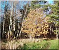
Small oak tree
Still hanging on to its leaves
Image: © Jim Smillie Taken: 28 Nov 2022
0.23 miles
8
Leaving Motherwell to the North
Looking along the A721 towards Bellshill.
Image: © G Laird Taken: 5 Oct 2008
0.23 miles
9
Cycleway Route
The main route going on a downward slope.
Image: © Ross Watson Taken: 19 Jul 2012
0.24 miles
10
Mountain bike track
On Northeast edge of Strathclyde Park
Image: © Jim Smillie Taken: 28 Nov 2022
0.24 miles