IMAGES TAKEN NEAR TO
North Orchard Street, MOTHERWELL, ML1 3JL

Introduction

This page details the photographs taken nearby to North Orchard Street, ML1 3JL by members of the Geograph project.

The Geograph project started in 2005 with the aim of publishing, organising and preserving representative images for every square kilometre of Great Britain, Ireland and the Isle of Man.

There are currently over 7.5m images from over14,400 individuals and you can help contribute to the project by visiting https://www.geograph.org.uk

Image Map


Images are licensed for reuse under creativecommons.org/licenses/by-sa/2.0
Notes
  • Clicking on the map will re-center to the selected point.
  • The higher the marker number, the further away the image location is from the centre of the postcode.

Image Listing (34 Images Found)

Images are licensed for reuse under creativecommons.org/licenses/by-sa/2.0
  • ...
Image
Details
Distance
1
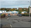
Workshop at end of North Orchard Street
Houses in background on site of Motherwell Bridge Works
Image: © Jim Smillie Taken: 13 Oct 2022
0.08 miles
2
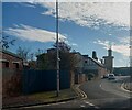
Ladywell Road, Motherwell
At the junction with Orchard Street and looking across the Clyde valley to Hamilton. For a close-up view of the Edward VII post box on the left, see Image
Image: © wrobison Taken: 26 Mar 2021
0.12 miles
3
Edward VII wall box, Motherwell
On a building at the corner of Ladywell Road and Orchard Street that dates from the reign of Edward VII (1901 – 1910), see Image for a wider view.
Image: © wrobison Taken: 26 Mar 2021
0.13 miles
4
Motherwell station junction
The Hamilton loop line on the left meets the West Coast Main Line, the latter curving sharply as it passes through Motherwell station.
Image: © Peter Whatley Taken: 21 Sep 2015
0.14 miles
5
Railway Lines
These lines are entering Image from the north. I was standing on the roof of Motherwell Heritage Centre when I took this photograph: Image
Image: © Lairich Rig Taken: 11 Mar 2005
0.15 miles
6
Ladywell Primary School
Primary School on Ladywell Road.
Image: © Ross Watson Taken: 19 Jul 2012
0.15 miles
7
Railway lines merging
Just outside Motherwell Station
Image: © Jim Smillie Taken: 13 Oct 2022
0.17 miles
8
Footbridge over railway lines
On corner at Ladywell Road and High Road
Image: © Jim Smillie Taken: 13 Oct 2022
0.17 miles
9
Station Footbridge
Footbridge over Motherwell railway Station.
Image: © Ross Watson Taken: 22 Jun 2012
0.18 miles
10
Farm Street
Old Maps show a farm named High Motherwell Tower at Motherwell Heritage Centre
Image: © Jim Smillie Taken: 13 Oct 2022
0.18 miles
  • ...