IMAGES TAKEN NEAR TO
Cameron Street, MOTHERWELL, ML1 3AH

Introduction

This page details the photographs taken nearby to Cameron Street, ML1 3AH by members of the Geograph project.

The Geograph project started in 2005 with the aim of publishing, organising and preserving representative images for every square kilometre of Great Britain, Ireland and the Isle of Man.

There are currently over 7.5m images from over14,400 individuals and you can help contribute to the project by visiting https://www.geograph.org.uk

Image Map


Images are licensed for reuse under creativecommons.org/licenses/by-sa/2.0
Notes
  • Clicking on the map will re-center to the selected point.
  • The higher the marker number, the further away the image location is from the centre of the postcode.

Image Listing (72 Images Found)

Images are licensed for reuse under creativecommons.org/licenses/by-sa/2.0
  • ...
Image
Details
Distance
1
Crawford Street, Motherwell
Image: © Alan O'Dowd Taken: 8 Jan 2011
0.05 miles
2
St Marys Church of Scotland, Motherwell
Image: © Elliott Simpson Taken: 28 Jan 2009
0.06 miles
3
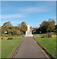
War Memorial
In Duchess of Hamilton Public Park
Image: © Jim Smillie Taken: 13 Oct 2022
0.08 miles
4
Tin Kirk
This prefabricated building, constructed of a timber frame clad in sheet metal, was apparently built in 1885 and pre-dates the stone building to which it is attached, having been used as the church itself for 10 years. It might not last much longer though as flats may be built on the site. I had assumed this building was a later extension to the church, but further info is below. http://canmore.rcahms.gov.uk/en/site/290062/details/motherwell+avon+street+church+of+the+holy+trinity+church+hall/
Image: © Alan O'Dowd Taken: 8 Jan 2011
0.09 miles
5
Open Area
The open area of the Duchess of Hamilton Park.
Image: © Ross Watson Taken: 22 Jun 2012
0.10 miles
6
Duchess of Hamilton Park, Motherwell
Image: © Elliott Simpson Taken: 28 Jan 2009
0.11 miles
7
Bridge over railway
Footbridge over Motherwell railroad, heading towards Avon Street
Image: © Ross Watson Taken: 22 Jun 2012
0.12 miles
8
Avon Street, Motherwell
Looking towards the tower of the old Town Hall. A couple of heavy snow showers had passed through giving the relatively rare sight of lying snow in the sheltered Clyde Valley.
Image: © Alan O'Dowd Taken: 16 Jan 2018
0.13 miles
9
Dalziel High School
The playground area of Dalziel High School, can also be used as a car park on non-school days.
Image: © Ross Watson Taken: 22 Jun 2012
0.13 miles
10
Classroom, Dalziel High School, Motherwell
Houses on Cadzow Street can just be seen in the distance.
Image: © Richard Sutcliffe Taken: Unknown
0.13 miles
  • ...