IMAGES TAKEN NEAR TO
Camp Road, MOTHERWELL, ML1 2RY

Introduction

This page details the photographs taken nearby to Camp Road, ML1 2RY by members of the Geograph project.

The Geograph project started in 2005 with the aim of publishing, organising and preserving representative images for every square kilometre of Great Britain, Ireland and the Isle of Man.

There are currently over 7.5m images from over14,400 individuals and you can help contribute to the project by visiting https://www.geograph.org.uk

Image Map


Images are licensed for reuse under creativecommons.org/licenses/by-sa/2.0
Notes
  • Clicking on the map will re-center to the selected point.
  • The higher the marker number, the further away the image location is from the centre of the postcode.

Image Listing (7 Images Found)

Images are licensed for reuse under creativecommons.org/licenses/by-sa/2.0
Image
Details
Distance
1
Emily Drive, Motherwell
A street of Burgh (Council) houses built around 1920. The street is named after Lady Emily Hamilton of Dalzell.
Image: © wrobison Taken: 8 Feb 2021
0.13 miles
2
Open Area
Swing Park and open area in Leven Street
Image: © Ross Watson Taken: 28 Jun 2012
0.19 miles
3
Snow on Adele Street, Motherwell
A wintry scene, featuring a miniature snowman at the bus stop.
Image: © Alan O'Dowd Taken: 9 Feb 2021
0.19 miles
4
Winter trees, Baron's Haugh Nature Reserve
Taken on a frosty day when the temperature failed to rise above freezing.
Image: © Alan O'Dowd Taken: 10 Dec 2017
0.21 miles
5
Dalzell Estate and Barons Haugh
Manse road, entrance to both the Estate and the Nature Reserve.
Image: © Ross Watson Taken: 11 Sep 2012
0.23 miles
6
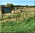
Access to meadow
The stile gives access to a wildflower meadow while the sign explains the use of grazing to maintain it
Image: © Jim Smillie Taken: 1 Sep 2021
0.24 miles
7
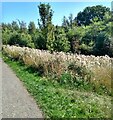
Thistles by the path
Now all gone to seed
Image: © Jim Smillie Taken: 1 Sep 2021
0.25 miles