IMAGES TAKEN NEAR TO
Range Road Industrial Estate, MOTHERWELL, ML1 2JE

Introduction

This page details the photographs taken nearby to Range Road Industrial Estate, ML1 2JE by members of the Geograph project.

The Geograph project started in 2005 with the aim of publishing, organising and preserving representative images for every square kilometre of Great Britain, Ireland and the Isle of Man.

There are currently over 7.5m images from over14,400 individuals and you can help contribute to the project by visiting https://www.geograph.org.uk

Image Map


Images are licensed for reuse under creativecommons.org/licenses/by-sa/2.0
Notes
  • Clicking on the map will re-center to the selected point.
  • The higher the marker number, the further away the image location is from the centre of the postcode.

Image Listing (13 Images Found)

Images are licensed for reuse under creativecommons.org/licenses/by-sa/2.0
Image
Details
Distance
1
Shields Glen footbridge
A footbridge over Whinny Burn in Shields Glen Public Park.
Image: © Ross Watson Taken: 12 Sep 2012
0.10 miles
2
Stairway towards Shields Glen
Pathway then stairway to the Shields Glen Public Park.
Image: © Ross Watson Taken: 12 Sep 2012
0.18 miles
3
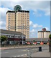
Muirhouse Flats
Modern flats on Shields Road.
Image: © Ross Watson Taken: 16 Aug 2012
0.19 miles
4
Shieldmuir railway station, Lanarkshire
Opened in 1990 by British Rail on the line from Motherwell to Carstairs. View north west towards Motherwell and Glasgow.
Image: © Nigel Thompson Taken: 15 Apr 2014
0.21 miles
5
Post office, Muirhouse
Image: © Richard Webb Taken: 9 Jan 2012
0.21 miles
6
Path to Shieldmuir Station
Train about to leave, heading to Motherwell
Image: © Jim Smillie Taken: 27 Feb 2023
0.21 miles
7
Shields Road
The photograph was taken from the junction with Netherwood Road, and is a view towards the junction with Muirhouse Road (where the low brick-red building is located). The background of the picture includes a couple of the Image; the nearer of the two stands alongside a street called Galloway Court.
Image: © Lairich Rig Taken: 10 Jun 2005
0.22 miles
8
Shields Glen
A park made up of a dean which extends east of the Shields Road from Dalzell Park.
Image: © Richard Webb Taken: 9 Jan 2012
0.22 miles
9
Shop, Muirhouse Road
A row of shops in the shadow of the towers.
Image: © Richard Webb Taken: 9 Jan 2012
0.23 miles
10
Modern Housing: Lochain Way
Lochnagar Road on left: Estate named as Colville Gardens on entrance wall
Image: © Jim Smillie Taken: 27 Feb 2023
0.23 miles