IMAGES TAKEN NEAR TO
Bryson Terrace, BIGGAR, ML12 6XQ

Introduction

This page details the photographs taken nearby to Bryson Terrace, ML12 6XQ by members of the Geograph project.

The Geograph project started in 2005 with the aim of publishing, organising and preserving representative images for every square kilometre of Great Britain, Ireland and the Isle of Man.

There are currently over 7.5m images from over14,400 individuals and you can help contribute to the project by visiting https://www.geograph.org.uk

Image Map


Images are licensed for reuse under creativecommons.org/licenses/by-sa/2.0
Notes
  • Clicking on the map will re-center to the selected point.
  • The higher the marker number, the further away the image location is from the centre of the postcode.

Image Listing (97 Images Found)

Images are licensed for reuse under creativecommons.org/licenses/by-sa/2.0
  • ...
Image
Details
Distance
1
Bryson Terrace
The lowest bit of Wanlockhead.
Image: © Richard Webb Taken: 14 Jun 1998
0.01 miles
2
The road to Wanlockhead
The radar sphere on the hilltop in the distance is at Green Lowther. The radar system is for the UK National Air Traffic Services.
Image: © Gordon Brown Taken: 11 Jul 2015
0.02 miles
3
Remains of smelting mill, Wanlockhead
This looks like the one (Pates Knowes) shown in http://www.mineexplorer.org.uk/pates_knowes_smelting_mill.htm .
Image: © Humphrey Bolton Taken: 12 Oct 2017
0.04 miles
4
Bryson Terrace and Glencrieff Cottages
A view of these houses on the road alongside the Wanlock Water, with the patchwork hillsides of Sowen Dod and Wanlock Dod under light snow cover as a backdrop. Taken from the top of the deeply eroded stream valley named Glencrieff.
Image: © Alan O'Dowd Taken: 24 Jan 2015
0.04 miles
5
Pates Knowes Lead Smelt Mill
Or at least, the remains of. Part of the industrial archaeology at the Museum of Lead Mining at Wanlockhead.
Image: © Gordon Brown Taken: 11 Jul 2015
0.04 miles
6
Lead Mining Relics at Wanlockhead
Foundations of former lead mining works high in the Lowther Hills. The lead was won from the mineral galena. http://en.wikipedia.org/wiki/Wanlockhead
Image: © Colin Smith Taken: 30 Aug 2009
0.06 miles
7
Church Street, Wanlockhead at Glencrieff Cottages
Looking north-westward.
Image: © Peter Wood Taken: 11 Sep 2017
0.07 miles
8
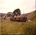
The mineral wagons near the Beam Engine, Wanlockhead
The wagons, which have deteriorated over the years, are now surrounded by a fence to stop kids trying to get a dog to pull them.
Image: © Elliott Simpson Taken: Unknown
0.07 miles
9
The mineral wagons near the Beam Engine, Wanlockhead
Image: © Elliott Simpson Taken: Unknown
0.08 miles
10
A plaque at Wanlockhead
The sketch shows the scene in photo Image as it was depicted in 1775
Image: © Elliott Simpson Taken: 10 Sep 2008
0.08 miles
  • ...