IMAGES TAKEN NEAR TO
Brandon Parade East, MOTHERWELL, ML1 1LY

Introduction

This page details the photographs taken nearby to Brandon Parade East, ML1 1LY by members of the Geograph project.

The Geograph project started in 2005 with the aim of publishing, organising and preserving representative images for every square kilometre of Great Britain, Ireland and the Isle of Man.

There are currently over 7.5m images from over14,400 individuals and you can help contribute to the project by visiting https://www.geograph.org.uk

Image Map


Images are licensed for reuse under creativecommons.org/licenses/by-sa/2.0
Notes
  • Clicking on the map will re-center to the selected point.
  • The higher the marker number, the further away the image location is from the centre of the postcode.

Image Listing (210 Images Found)

Images are licensed for reuse under creativecommons.org/licenses/by-sa/2.0
  • ...
Image
Details
Distance
1
Merry Street bus stop and one-way road
Bus stop and one way road in Merry Street, allowing commuters access to Motherwell Shopping Centre. Phase 1 town centre modernization works have been completed.
Image: © Ross Watson Taken: 19 Jul 2012
0.02 miles
2
Merry Street
Shops at Brandon Parade East in the pedestrianised section of Merry Street.
Image: © Thomas Nugent Taken: 3 Jan 2018
0.02 miles
3
Merry Street pedestrianised area
Formerly a road, now mainly converted into a pedestrianised area, and has recently undergone modernization works.
Image: © Ross Watson Taken: 19 Jul 2012
0.02 miles
4
Motherwell Railway Station
Billboard seen just outside Motherwell rail station made me think that with the current political climate in Egypt it was pretty hot all year round at the moment and not somewhere I'd go for a holiday.
Image: © Andy Farrington Taken: 7 Feb 2011
0.03 miles
5
British Heart Foundation shop, Motherwell
One of two BHF shops on Brandon Parade East, the other is for furniture and electrical goods.
Image: © Thomas Nugent Taken: 3 Jan 2018
0.03 miles
6
Dalziel St Andrews Parish Church
A Category B Listed http://portal.historicenvironment.scot/designation/LB48311 Church of Scotland building at the corner of Merry Street and Pollock Street.
Image: © Thomas Nugent Taken: 3 Jan 2018
0.03 miles
7
Motherwell Tree
The red 'Motherwell Tree', re-located during modernization works.
Image: © Ross Watson Taken: 22 Jun 2012
0.03 miles
8
Merry Street
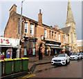
Looking past the West Coast Main Line railway bridge towards the Railway Tavern and Dalziel Parish Church.
Image: © Thomas Nugent Taken: 3 Jan 2018
0.04 miles
9
Merry Street
Looking past the West Coast Main Line railway bridge towards the Railway Tavern and Dalziel Parish Church.
Image: © Thomas Nugent Taken: 3 Jan 2018
0.04 miles
10
The Railway Tavern
A Category C Listed public house http://portal.historicenvironment.scot/designation/LB48312 on Merry Street.
Image: © Thomas Nugent Taken: 3 Jan 2018
0.04 miles
  • ...