IMAGES TAKEN NEAR TO
Kirkfieldbank Road, LANARK, ML11 9TS

Introduction

This page details the photographs taken nearby to Kirkfieldbank Road, ML11 9TS by members of the Geograph project.

The Geograph project started in 2005 with the aim of publishing, organising and preserving representative images for every square kilometre of Great Britain, Ireland and the Isle of Man.

There are currently over 7.5m images from over14,400 individuals and you can help contribute to the project by visiting https://www.geograph.org.uk

Image Map


Images are licensed for reuse under creativecommons.org/licenses/by-sa/2.0
Notes
  • Clicking on the map will re-center to the selected point.
  • The higher the marker number, the further away the image location is from the centre of the postcode.

Image Listing (12 Images Found)

Images are licensed for reuse under creativecommons.org/licenses/by-sa/2.0
Image
Details
Distance
1
Approaching Sandilands from the south
Image: © Elliott Simpson Taken: 14 Sep 2016
0.02 miles
2
Minor road winding through pass
Between Burnhouse Mill and Sandilands
Image: © Robert Murray Taken: 8 Apr 2016
0.06 miles
3
House for a stationmaster
In the foreground is the embankment of the former Muirkirk to Lanark railway line, still showing marks in the grass where sleepers once supported the rails. The grey brick wall was built when the bridge across the road was demolished. The platform of the former Sandilands station was just beyond the bridge and the cottage on the road below, with its neat porch, was provided for the station agent. The station was closed during 1964.
Image: © A-M-Jervis Taken: 24 Sep 2005
0.10 miles
4
Building at Burnhousemill
Image: © Iain Thompson Taken: 24 Nov 2006
0.12 miles
5
Wet tracks near Sandilands
The drainage of the former Muirkirk to Lanark railway line has collapsed in the cutting north of Bridge 15, resulting in a permanent bog. Sandilands station was amongst the trees in the distance, beyond which the old railway line can be seen curving left on an embankment.
Image: © A-M-Jervis Taken: 24 Sep 2005
0.16 miles
6
Burn Near Sandilands
Image: © Iain Thompson Taken: 24 Nov 2006
0.17 miles
7
Drumalbin Burn
A small tributary of the Douglas Water which in turn flows into the River Clyde.
Image: © G Laird Taken: 2 Sep 2013
0.17 miles
8
Dismantled railway at Sandilands
Image: © Iain Macaulay Taken: 21 Oct 2005
0.19 miles
9
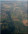
The River Clyde at Sandiland from the air
The course of the Douglas Branch of the Caledonian Railway can be discerned at the bottom of the photo, as can several earth mounds, highlighted by the late evening sun. Douglas Water can be seen entering the Clyde at Crookboat Farm. Viewed from a Glasgow bound flight from Heathrow.
Image: © Thomas Nugent Taken: 28 Aug 2015
0.19 miles
10
Road at Sandilands
Looking north-westward.
Image: © Peter Wood Taken: 15 Sep 2016
0.20 miles