IMAGES TAKEN NEAR TO
Hazel Gardens, LANARK, ML11 9FR

Introduction

This page details the photographs taken nearby to Hazel Gardens, ML11 9FR by members of the Geograph project.

The Geograph project started in 2005 with the aim of publishing, organising and preserving representative images for every square kilometre of Great Britain, Ireland and the Isle of Man.

There are currently over 7.5m images from over14,400 individuals and you can help contribute to the project by visiting https://www.geograph.org.uk

Image Map


Images are licensed for reuse under creativecommons.org/licenses/by-sa/2.0
Notes
  • Clicking on the map will re-center to the selected point.
  • The higher the marker number, the further away the image location is from the centre of the postcode.

Image Listing (14 Images Found)

Images are licensed for reuse under creativecommons.org/licenses/by-sa/2.0
Image
Details
Distance
1
Gravestone of William Harvey, a Covenanter
The inscription is on the other side of the stone (although part of it is also visible on the top); for a view of the other side, and for the story behind William Harvey's death, see Image
Image: © Lairich Rig Taken: 8 Jul 2005
0.10 miles
2
Cemetery Chapel, Lanark
This building is located within the graveyard of the old St Kentigern's Church; for a view in context, see Image See http://portal.historic-scotland.gov.uk/designation/LB37029 (at Historic Environment Scotland) for an architectural summary of the structure.
Image: © Lairich Rig Taken: 8 Jul 2005
0.15 miles
3
Graveyard of the old St Kentigern's Church
The present-day St Kentigern's Church is located in Hope Street, in the town of Lanark. The old church is represented only by some arches: Image The prominent structure in the background is Image
Image: © Lairich Rig Taken: 8 Jul 2005
0.15 miles
4
Gravestone of William Harvey, a Covenanter
This stone is in the graveyard of the old St Kentigern's Church, and is that of a Lanark weaver named William Harvey ("Hervi"), who was tried at the Justiciary Court in Edinburgh in February 1682, and executed on the 2nd of March of that year. The other side of his gravestone bears only a skull-and-crossbones design, shown at Image
Image: © Lairich Rig Taken: 8 Jul 2005
0.15 miles
5
Cemetery chapel at St. Kentigern's
Image: © kim traynor Taken: 5 Oct 2010
0.16 miles
6
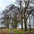
The Beeches Lanark
A track giving access towards New Lanark. There are a number of dead trees and gaps now
Image: © Jim Smillie Taken: 28 Dec 2021
0.19 miles
7
St Kentigern's Church (ruins)
Located on the outskirts of Lanark, this church was known as the Out Kirk or High Kirk, to distinguish it from St Nicholas' Parish Church, which is located within the town. According to a local tradition, William Wallace married Marion Braidfute at this church. The ruins of the church are seen to the right of the photo; the arches (dating from the fifteenth century) are alternately round and octagonal in cross-section. As is explained by an inscription at the site, this arcade collapsed on the night of 7th April 1954 (after a storm), and was rebuilt by order of the Town Council of the Royal Borough of Lanark, the work being completed in August 1954. The photo was taken from close to the main entrance of the churchyard (which is on its north-western side).
Image: © Lairich Rig Taken: 8 Jul 2005
0.20 miles
8
Undulating farmland near Lanark
A view from The Beeches across farmland with Tinto Hill in the distance.
Image: © Alan O'Dowd Taken: 15 Jul 2019
0.22 miles
9
Bridge tollgates
Surveyed by the Milestone Society. These gates from the former Cartland Bridge Toll are well preserved at the side of the A73 Hyndford Road, eastwards out of Lanark.
Image: © Chris Minto Taken: 11 Apr 2009
0.22 miles
10
Tollgate plaque
Surveyed by the Milestone Society. The plaque by the former toll gates from Cartland Bridge Toll, on Hyndford Road.
Image: © Chris Minto Taken: 11 Apr 2009
0.22 miles