IMAGES TAKEN NEAR TO
Carstairs Junction, LANARK, ML11 8SA

Introduction

This page details the photographs taken nearby to ML11 8SA by members of the Geograph project.

The Geograph project started in 2005 with the aim of publishing, organising and preserving representative images for every square kilometre of Great Britain, Ireland and the Isle of Man.

There are currently over 7.5m images from over14,400 individuals and you can help contribute to the project by visiting https://www.geograph.org.uk

Image Map


Images are licensed for reuse under creativecommons.org/licenses/by-sa/2.0
Notes
  • Clicking on the map will re-center to the selected point.
  • The higher the marker number, the further away the image location is from the centre of the postcode.

Image Listing (5 Images Found)

Images are licensed for reuse under creativecommons.org/licenses/by-sa/2.0
Image
Details
Distance
1
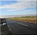
The A70 Near Carstairs
The A70 and A721 share the same route for a short distance. The road is flanked by glacial deposits of sand and gravel, produced by meltwater rivers at the end of the last Ice Age.
Image: © Mary and Angus Hogg Taken: 25 May 2012
0.05 miles
2
A70 east of Carstairs
Image: © David Dixon Taken: 4 Mar 2020
0.09 miles
3
White Hill
Or what is left of it - a stump full of rabbit holes. Like nearby Lang Hill, it has been quarried away. The hills were originally sandy deposits from a river running through a glacier. Surviving long sandy hills, kaimes, can be seen nearby.
Image: © Richard Webb Taken: 31 Aug 2006
0.14 miles
4
Lang Hill
Glacial deposit terrain. There was a similar hill to the background one here, but it has been quarried away and landscaped as a flat field.
Image: © Richard Webb Taken: 27 Jan 2005
0.18 miles
5
The A721 heading west between Carnwath and Carstairs
In South Lanarkshire.
Image: © James Denham Taken: 30 Nov 2013
0.19 miles