IMAGES TAKEN NEAR TO
Lesmahagow, LANARK, ML11 0HW

Introduction

This page details the photographs taken nearby to ML11 0HW by members of the Geograph project.

The Geograph project started in 2005 with the aim of publishing, organising and preserving representative images for every square kilometre of Great Britain, Ireland and the Isle of Man.

There are currently over 7.5m images from over14,400 individuals and you can help contribute to the project by visiting https://www.geograph.org.uk

Image Map


Images are licensed for reuse under creativecommons.org/licenses/by-sa/2.0
Notes
  • Clicking on the map will re-center to the selected point.
  • The higher the marker number, the further away the image location is from the centre of the postcode.

Image Listing (5 Images Found)

Images are licensed for reuse under creativecommons.org/licenses/by-sa/2.0
Image
Details
Distance
1
Rhododendrons outside Birkenhead farm
'Rhodies' are so prevalent and successful in the Scottish climate that 'rhodie bashing expeditions' are sometimes mounted to drag out these plants which can takeover a whole hillside.
Image: © Gordon Brown Taken: 8 Jun 2007
0.10 miles
2
Cleughhead farm from the air
Seen through a break in the cloud from a Prague bound flight from Glasgow.
Image: © Thomas Nugent Taken: 9 Oct 2017
0.12 miles
3
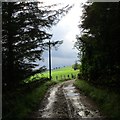
Emerging into sunlight near Birkenhead
This track has a brief dank section between two strip woods before emerging into the open again.
Image: © Alan O'Dowd Taken: 1 Aug 2019
0.17 miles
4
Beyond Birkenhead, on the road to Logan
A fine stand of old beech trees.
Image: © Gordon Brown Taken: 8 Jun 2007
0.17 miles
5
Track west of Birkenhead
Farmland and small conifer plantations in rural Lanarkshire.
Image: © Alan O'Dowd Taken: 1 Aug 2019
0.21 miles