1
Site of Glassford station
View southward, towards Strathaven North: ex-Caledonian Railway branch from Blantyre, thence Glasgow via Newton. The station and branch were closed to passengers 30/9/45, to goods 21/9/53 - so it is not surprising there is nothing visible remaining. In the distance are the hills in the Muirkirk area, with Cairn Table (1,944 ft.).
Image: © Ben Brooksbank
Taken: 28 Jun 1998
0.12 miles
2
Whitecraigs
Farmland near Glassford.
Image: © Richard Webb
Taken: 17 Apr 2017
0.17 miles
3
An old bus stop in the middle of no-where
I wonder when the last bus came along this road.
Image: © Elliott Simpson
Taken: 4 Aug 2007
0.21 miles
4
Heads Road, near Glassford
A brief episode of winter conditions in the lowlands, as a cold few days culminated an overnight snowfall that would mostly be gone the day after this photo was taken, as a warm front moved in from the west.
Image: © Alan O'Dowd
Taken: 7 Jan 2022
0.21 miles
5
Crossroads by Whitecraigs
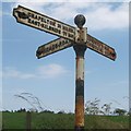
The road continues to Glassford with an old cast iron signpost pointing northwards towards Heads. There is a missing arm towards the southern road towards Strathaven.
Image: © Richard Webb
Taken: 17 Apr 2017
0.21 miles
6
Country road crossroads
Station Road runs west from Glassford until it meets the A723 Strathaven-Hamilton Road. At this crossroads minor roads go to Strathaven (left) and to the small village of Heads (right). The old sign is seen close up in
Image; note the old spelling of "Glassford" with just one 's'.
Image: © Alec MacKinnon
Taken: 5 Nov 2020
0.21 miles
7
Restored signpost near Glassford
Sometime between 23/02/2020 and 16/07/2021 the missing arm has been re-instated, see
Image and
Image and
Image
Image: © wrobison
Taken: 16 Jul 2021
0.22 miles
8
Crossroads with old signpost at Heads of Glassford
The visible fingers of the signpost point to Chapelton and East Kilbride (probably still a rural village when this signpost was erected) on the left, Strathaven and Darvel on the right, and the Heads Road, running towards the back-left of the photo.
Image: © Alan O'Dowd
Taken: 7 Jan 2022
0.22 miles
9
Direction Sign ? Signpost
Located on the northeast side of a T junction west of Glassford. 3 arms, 1 missing, and ball finial. See also https://www.geograph.org.uk/photo/1459196 and https://www.geograph.org.uk/photo/6397609.
Milestone Society National ID: LNC_NS7147
Image: © A Weighill
Taken: 2 Aug 2019
0.22 miles
10
Old signpost at rural crossroads near Glassford
The side of the signpost facing the camera points left to the Heads Road, a dead-end road which gives access to Heads House and the farm at Wellgreen.
Image: © Alan O'Dowd
Taken: 23 Feb 2020
0.22 miles


