IMAGES TAKEN NEAR TO
Dalgin Place, MILTON KEYNES, MK9 4AS
Introduction
This page details the photographs taken nearby to Dalgin Place, MK9 4AS by members of the Geograph project.
The Geograph project started in 2005 with the aim of publishing, organising and preserving representative images for every square kilometre of Great Britain, Ireland and the Isle of Man.

There are currently over 7.5m images from over14,400 individuals and you can help contribute to the project by visiting https://www.geograph.org.uk
Image Map
Images are licensed for reuse under creativecommons.org/licenses/by-sa/2.0
Notes
- Clicking on the map will re-center to the selected point.
- The higher the marker number, the further away the image location is from the centre of the postcode.
Image Listing (46 Images Found)
Images are licensed for reuse under creativecommons.org/licenses/by-sa/2.0
Image
Details
Distance
5
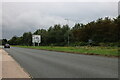
Childs Way, Milton Keynes
The roundabout sign has arrived in the last few years. It used to be on the left.
Image: © David Howard
Taken: 22 Aug 2021
0.06 miles
6
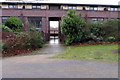
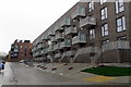
Entrance to apartments on Avebury Boulevard
Image: © Philip Jeffrey
Taken: 4 Feb 2018
0.09 miles
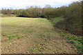
10
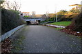
Path and cycle track under Enmore Gate
Image: © Philip Jeffrey
Taken: 7 Jan 2018
0.11 miles