IMAGES TAKEN NEAR TO
Porthleven Place, MILTON KEYNES, MK6 2BA
Introduction
This page details the photographs taken nearby to Porthleven Place, MK6 2BA by members of the Geograph project.
The Geograph project started in 2005 with the aim of publishing, organising and preserving representative images for every square kilometre of Great Britain, Ireland and the Isle of Man.

There are currently over 7.5m images from over14,400 individuals and you can help contribute to the project by visiting https://www.geograph.org.uk
Image Map
Images are licensed for reuse under creativecommons.org/licenses/by-sa/2.0
Notes
- Clicking on the map will re-center to the selected point.
- The higher the marker number, the further away the image location is from the centre of the postcode.
Image Listing (30 Images Found)
Images are licensed for reuse under creativecommons.org/licenses/by-sa/2.0
Image
Details
Distance
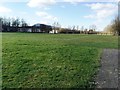
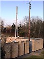
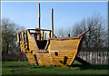
3
The Junction of Fishermead Boulevard and Pencarrow Place
Image: © Cameraman
Taken: 10 Dec 2009
0.13 miles
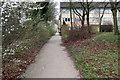
6
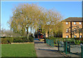
View Towards Mullion Place
From Fishermead Play Area.
Image: © Cameraman
Taken: 10 Dec 2009
0.16 miles
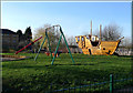
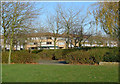
8
Kid-Proof Exercise Machine, Fishermead Play Area
Image: © Cameraman
Taken: 10 Dec 2009
0.18 miles
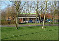
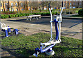
10
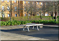
A Tough Ping-Pong Table
In Fishermead Play Area.
Image: © Cameraman
Taken: 10 Dec 2009
0.19 miles