IMAGES TAKEN NEAR TO
Lower Gravenhurst, BEDFORD, MK45 4HL
Introduction
This page details the photographs taken nearby to Lower Gravenhurst, MK45 4HL by members of the Geograph project.
The Geograph project started in 2005 with the aim of publishing, organising and preserving representative images for every square kilometre of Great Britain, Ireland and the Isle of Man.

There are currently over 7.5m images from over14,400 individuals and you can help contribute to the project by visiting https://www.geograph.org.uk
Image Map
Images are licensed for reuse under creativecommons.org/licenses/by-sa/2.0
Notes
- Clicking on the map will re-center to the selected point.
- The higher the marker number, the further away the image location is from the centre of the postcode.
Image Listing (20 Images Found)
Images are licensed for reuse under creativecommons.org/licenses/by-sa/2.0
Image
Details
Distance
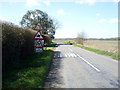
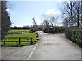
1
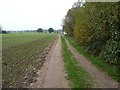
Bridleway to Silsoe
On the west side of Fielden Court.
Image: © Christine Johnstone
Taken: 30 Oct 2014
0.04 miles
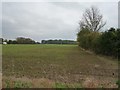
3
Farmland between Fielden Court and Fielden House
Between the two parallel bridleways, looking south-west.
Image: © Christine Johnstone
Taken: 30 Oct 2014
0.05 miles
4
Bridleway alongside Fielden Court
Beyond the wood it connects with a footpath to Higham Gobion.
Image: © Christine Johnstone
Taken: 30 Oct 2014
0.05 miles
5
Heading south west near Fielden Court
Towards the A6.
Image: © JThomas
Taken: 25 Mar 2016
0.05 miles
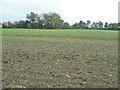
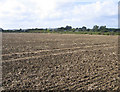
6
Patterns in an emerging crop near Fielden Court
On the south-east side of the road from the A6 to Lower Gravenhurst.
Image: © Christine Johnstone
Taken: 30 Oct 2014
0.08 miles
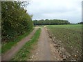
7
Bridleway towards Fielden Court
Heading south east.
Image: © JThomas
Taken: 25 Mar 2016
0.08 miles
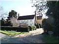
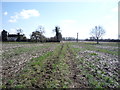
8
View near Fielden Court, Silsoe, Beds
– looking W with Pulloxhill water tower in the distance.
Image: © Rodney Burton
Taken: 27 Sep 2005
0.09 miles
10
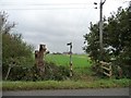
Bridleway signpost and bridge, near Fielden House
The bridleway was mapped in 2004 as heading straight up the Fielden House drive, but it has since been diverted round the field boundary. The drive is just visible behind the signpost.
Image: © Christine Johnstone
Taken: 30 Oct 2014
0.13 miles