IMAGES TAKEN NEAR TO
Church Mews, BEDFORD, MK45 4BB
Introduction
This page details the photographs taken nearby to Church Mews, MK45 4BB by members of the Geograph project.
The Geograph project started in 2005 with the aim of publishing, organising and preserving representative images for every square kilometre of Great Britain, Ireland and the Isle of Man.

There are currently over 7.5m images from over14,400 individuals and you can help contribute to the project by visiting https://www.geograph.org.uk
Image Map
Images are licensed for reuse under creativecommons.org/licenses/by-sa/2.0
Notes
- Clicking on the map will re-center to the selected point.
- The higher the marker number, the further away the image location is from the centre of the postcode.
Image Listing (15 Images Found)
Images are licensed for reuse under creativecommons.org/licenses/by-sa/2.0
Image
Details
Distance
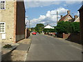
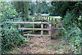
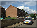
1
Church Mews off Great Lane, Clophill, Beds
Image: © Mick Malpass
Taken: 15 Mar 2012
0.01 miles
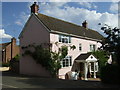
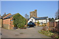
2
New St Mary's Church
Built in 1840 to replace the old one. Old St Mary's is now a ruin. See http://www.geograph.org.uk/photo/64919
Image: © Bikeboy
Taken: 2 Jan 2014
0.01 miles
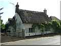
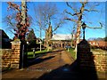
3
Parish church, Clophill, Beds
Dedicated to St Mary; erected 1848 near the village centre of local sandstone.
Image: © Rodney Burton
Taken: 13 Oct 2005
0.04 miles
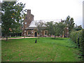
5
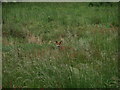
Who is watching who?
Young fox in grassland, south of houses in Clophill. He/she ran off a little while later, appeared to be a juvenile
Image: © Dennis simpson
Taken: 3 Jun 2011
0.14 miles