IMAGES TAKEN NEAR TO
Harrows Close, BEDFORD, MK45 3FG
Introduction
This page details the photographs taken nearby to Harrows Close, MK45 3FG by members of the Geograph project.
The Geograph project started in 2005 with the aim of publishing, organising and preserving representative images for every square kilometre of Great Britain, Ireland and the Isle of Man.

There are currently over 7.5m images from over14,400 individuals and you can help contribute to the project by visiting https://www.geograph.org.uk
Image Map
Images are licensed for reuse under creativecommons.org/licenses/by-sa/2.0
Notes
- Clicking on the map will re-center to the selected point.
- The higher the marker number, the further away the image location is from the centre of the postcode.
Image Listing (9 Images Found)
Images are licensed for reuse under creativecommons.org/licenses/by-sa/2.0
Image
Details
Distance
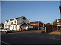
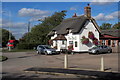
5
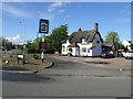
"The Bell"
The Bell is an old, probably 17th century, thatched pub.
Image: © Jeff Tomlinson
Taken: 7 May 2007
0.12 miles
6
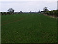
Farmland South of Cotton End
Cereal crop growing in a field.
Image: © Dennis simpson
Taken: 13 Apr 2009
0.12 miles