IMAGES TAKEN NEAR TO
Station Lane, BEDFORD, MK45 2YU
Introduction
This page details the photographs taken nearby to Station Lane, MK45 2YU by members of the Geograph project.
The Geograph project started in 2005 with the aim of publishing, organising and preserving representative images for every square kilometre of Great Britain, Ireland and the Isle of Man.

There are currently over 7.5m images from over14,400 individuals and you can help contribute to the project by visiting https://www.geograph.org.uk
Image Map
Images are licensed for reuse under creativecommons.org/licenses/by-sa/2.0
Notes
- Clicking on the map will re-center to the selected point.
- The higher the marker number, the further away the image location is from the centre of the postcode.
Image Listing (8 Images Found)
Images are licensed for reuse under creativecommons.org/licenses/by-sa/2.0
Image
Details
Distance
1
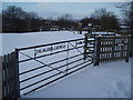
Millbrook Proving Ground
Discrete vehicle testing ground built as a testing site for General Motors in the 1960s.
Details from http://www.millbrook.co.uk/
Image: © Andrew Tatlow
Taken: 16 Mar 2008
0.11 miles
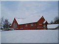
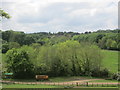
3
The Alfred Everitt Playing Field, Millbrook
Image: © Mike Nicholson
Taken: 9 Jan 2010
0.19 miles
5
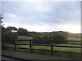
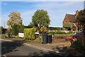
Woodlands by Sandhill Close, Millbrook
Image: © David Howard
Taken: 28 Jul 2016
0.22 miles
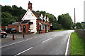
6
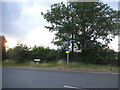
Station Lane, Millbrook
There really is a station in this village, the Bletchley-Bedford line was salvaged from the Oxford-Cambridge line and extended to Bicester in the early 1990s. It may still be stretched further.
Image: © David Howard
Taken: 28 Jul 2016
0.22 miles