IMAGES TAKEN NEAR TO
The Crescent, BEDFORD, MK45 2QS
Introduction
This page details the photographs taken nearby to The Crescent, MK45 2QS by members of the Geograph project.
The Geograph project started in 2005 with the aim of publishing, organising and preserving representative images for every square kilometre of Great Britain, Ireland and the Isle of Man.

There are currently over 7.5m images from over14,400 individuals and you can help contribute to the project by visiting https://www.geograph.org.uk
Image Map
Images are licensed for reuse under creativecommons.org/licenses/by-sa/2.0
Notes
- Clicking on the map will re-center to the selected point.
- The higher the marker number, the further away the image location is from the centre of the postcode.
Image Listing (25 Images Found)
Images are licensed for reuse under creativecommons.org/licenses/by-sa/2.0
Image
Details
Distance
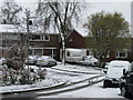
1
Early Spring Blossom
The Crescent, Ampthill.
Image: © Dennis simpson
Taken: 24 Feb 2008
0.08 miles
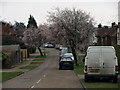
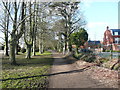
2
Holland Road, Ampthill
Taken on Easter morning. Large no through road with mainly 1960s built housing.
Image: © Dennis simpson
Taken: 23 Mar 2008
0.08 miles
3
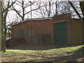
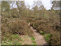
Scout Hut
Just into the woods on the heathland. Accessed via Station Road.
Image: © Dennis simpson
Taken: 6 Apr 2008
0.10 miles
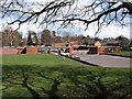
4
Private road at the end of Ashburnham Road
Image: © Philip Jeffrey
Taken: 11 May 2013
0.11 miles
5
The Firs Lower School
One of two lower schools in Ampthill.
Image: © Dennis simpson
Taken: 6 Apr 2008
0.12 miles
6
Bridleway off Station Road, Ampthill
Image: © Humphrey Bolton
Taken: 19 Mar 2018
0.16 miles
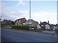
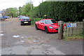
8
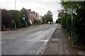
Pedestrian crossing on Flitwick Road
Image: © Philip Jeffrey
Taken: 11 May 2013
0.16 miles