IMAGES TAKEN NEAR TO
Burghley Close, BEDFORD, MK45 1TF
Introduction
This page details the photographs taken nearby to Burghley Close, MK45 1TF by members of the Geograph project.
The Geograph project started in 2005 with the aim of publishing, organising and preserving representative images for every square kilometre of Great Britain, Ireland and the Isle of Man.

There are currently over 7.5m images from over14,400 individuals and you can help contribute to the project by visiting https://www.geograph.org.uk
Image Map
Images are licensed for reuse under creativecommons.org/licenses/by-sa/2.0
Notes
- Clicking on the map will re-center to the selected point.
- The higher the marker number, the further away the image location is from the centre of the postcode.
Image Listing (8 Images Found)
Images are licensed for reuse under creativecommons.org/licenses/by-sa/2.0
Image
Details
Distance
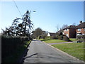
3
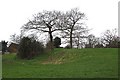
Motte & Bailey, Flitwick
Marked on the map as a Motte & Bailey, this was presumably the site of an ancient castle. The area is still known as "The Mount" and the earthworks are still clearly visible.
Image: © Rob Farrow
Taken: 22 Feb 2007
0.19 miles
5
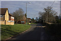
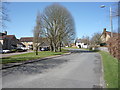
Church Road, Flitwick, looking north westwards.
Image: © Robert Eva
Taken: 7 Feb 2018
0.21 miles
7
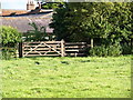
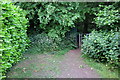
Gate and Stile
At the point where the footpath enters a farm yard.
Image: © Dennis simpson
Taken: 28 May 2009
0.22 miles
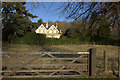
8
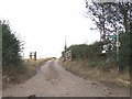
Lanes, paths and bridleways junction
The road changes gauge at this point, while a footpath and a bridleway strike off to the west and northwest and an unclassified track also diverges northeastwards. Considering all that, it's actually not very interesting !
Image: © Rob Farrow
Taken: 15 Aug 2006
0.25 miles