IMAGES TAKEN NEAR TO
Townfield Road, BEDFORD, MK45 1JQ
Introduction
This page details the photographs taken nearby to Townfield Road, MK45 1JQ by members of the Geograph project.
The Geograph project started in 2005 with the aim of publishing, organising and preserving representative images for every square kilometre of Great Britain, Ireland and the Isle of Man.

There are currently over 7.5m images from over14,400 individuals and you can help contribute to the project by visiting https://www.geograph.org.uk
Image Map
Images are licensed for reuse under creativecommons.org/licenses/by-sa/2.0
Notes
- Clicking on the map will re-center to the selected point.
- The higher the marker number, the further away the image location is from the centre of the postcode.
Image Listing (16 Images Found)
Images are licensed for reuse under creativecommons.org/licenses/by-sa/2.0
Image
Details
Distance


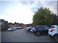
5
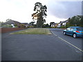
Glebe Avenue looking towards the A5120, Flitwick
Image: © David Howard
Taken: 28 Jul 2016
0.15 miles
6
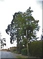
Glebe Avenue at the junction of the A5120
Image: © David Howard
Taken: 28 Jul 2016
0.15 miles
8
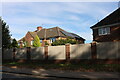
Houses on Dunstable Road, Flitwick
The fence panels have just been added, replacing railings.
Image: © David Howard
Taken: 9 Oct 2022
0.17 miles
9
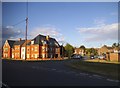
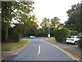
Vicarage Hill at the junction of the A5120
Image: © David Howard
Taken: 28 Jul 2016
0.18 miles
10

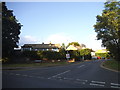
Vicarage Hill at the junction of the A5120
Image: © David Howard
Taken: 28 Jul 2016
0.18 miles