IMAGES TAKEN NEAR TO
Bronte Avenue, MILTON KEYNES, MK4 4LQ
Introduction
This page details the photographs taken nearby to Bronte Avenue, MK4 4LQ by members of the Geograph project.
The Geograph project started in 2005 with the aim of publishing, organising and preserving representative images for every square kilometre of Great Britain, Ireland and the Isle of Man.

There are currently over 7.5m images from over14,400 individuals and you can help contribute to the project by visiting https://www.geograph.org.uk
Image Map
Images are licensed for reuse under creativecommons.org/licenses/by-sa/2.0
Notes
- Clicking on the map will re-center to the selected point.
- The higher the marker number, the further away the image location is from the centre of the postcode.
Image Listing (12 Images Found)
Images are licensed for reuse under creativecommons.org/licenses/by-sa/2.0
Image
Details
Distance
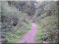
2
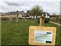
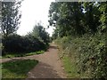
Kingsmead play area
Closed by the virus
Image: © Philip Jeffrey
Taken: 1 Apr 2020
0.08 miles
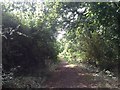
3
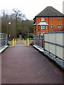
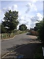
The old path from the new footbridge
Image: © Philip Jeffrey
Taken: 24 Feb 2012
0.08 miles
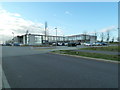
5
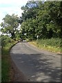
New housing on the edge of Milton Keynes
Image: © Philip Jeffrey
Taken: 24 Feb 2012
0.19 miles
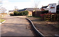
6
Priory Rise School
Opened in September 2008 to serve the communities of Tattenhoe Park and South Kingsmead.
Image: © Malcolm Campbell
Taken: 23 Jan 2012
0.20 miles
8
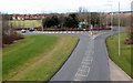
North Bucks Way Milton Keynes Boundary Walk
This is the view north on the Milton Keynes Boundary Walk where just after the Midshires Way turns off and the North Buckinghamshire Way joins up.
Image: © Mr Biz
Taken: 9 Aug 2006
0.22 miles