IMAGES TAKEN NEAR TO
Oakham Rise, MILTON KEYNES, MK4 4EA
Introduction
This page details the photographs taken nearby to Oakham Rise, MK4 4EA by members of the Geograph project.
The Geograph project started in 2005 with the aim of publishing, organising and preserving representative images for every square kilometre of Great Britain, Ireland and the Isle of Man.

There are currently over 7.5m images from over14,400 individuals and you can help contribute to the project by visiting https://www.geograph.org.uk
Image Map
Images are licensed for reuse under creativecommons.org/licenses/by-sa/2.0
Notes
- Clicking on the map will re-center to the selected point.
- The higher the marker number, the further away the image location is from the centre of the postcode.
Image Listing (14 Images Found)
Images are licensed for reuse under creativecommons.org/licenses/by-sa/2.0
Image
Details
Distance
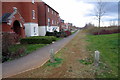
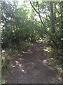
2
Bottlehouse edge
Tenby Grove at Kingsmead which overlooks farmland to the west.
Image: © Malcolm Campbell
Taken: 5 Mar 2009
0.11 miles
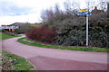
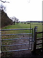
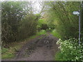
7
Dog bin
Lonely dog bin on a muddy path.
Image: © Malcolm Campbell
Taken: 5 Mar 2009
0.14 miles

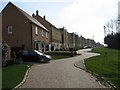
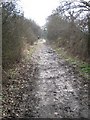
9
Path around the Whitney Roundabout
Path around the Whitney Roundabout heading under Snelshall Street
Image: © Shaun Ferguson
Taken: 2 May 2014
0.15 miles
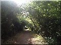
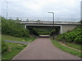
10
Swan's Way
Swan's Way comes out from Whaddon to head straight ahead to Oakhill Wood
Image: © Shaun Ferguson
Taken: 2 May 2014
0.15 miles