IMAGES TAKEN NEAR TO
Chapel Field, BEDFORD, MK44 3JT
Introduction
This page details the photographs taken nearby to Chapel Field, MK44 3JT by members of the Geograph project.
The Geograph project started in 2005 with the aim of publishing, organising and preserving representative images for every square kilometre of Great Britain, Ireland and the Isle of Man.

There are currently over 7.5m images from over14,400 individuals and you can help contribute to the project by visiting https://www.geograph.org.uk
Image Map
Images are licensed for reuse under creativecommons.org/licenses/by-sa/2.0
Notes
- Clicking on the map will re-center to the selected point.
- The higher the marker number, the further away the image location is from the centre of the postcode.
Image Listing (21 Images Found)
Images are licensed for reuse under creativecommons.org/licenses/by-sa/2.0
Image
Details
Distance
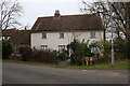
1
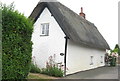
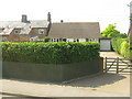
'Touch Wood'
A small thatched cottage on Green End Road, Great Barford.
Image: © M J Richardson
Taken: 28 Jun 2015
0.09 miles
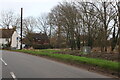
3
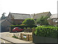
Chapel, Bedford Road
A small village now by-passed by a dual carriageway.
Image: © M J Richardson
Taken: 13 Jul 2013
0.11 miles
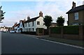
4
Houses at Great Barford
On Bedford Road.
Image: © M J Richardson
Taken: 13 Jul 2013
0.11 miles
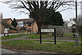
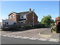
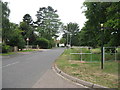
6
Roxton Road, Great Barford
At the end of High Street. Here is an earlier view. https://www.geograph.org.uk/photo/7085547
Image: © David Howard
Taken: 19 Feb 2023
0.17 miles
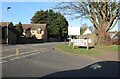
8
Green End Road, Great Barford
From the junction with Fishers Close
Image: © M J Richardson
Taken: 28 Jun 2015
0.18 miles
9
Cottage on Green End Road, Great Barford
Image: © David Howard
Taken: 30 Jan 2022
0.19 miles