IMAGES TAKEN NEAR TO
High Street, BEDFORD, MK44 3EB
Introduction
This page details the photographs taken nearby to High Street, MK44 3EB by members of the Geograph project.
The Geograph project started in 2005 with the aim of publishing, organising and preserving representative images for every square kilometre of Great Britain, Ireland and the Isle of Man.

There are currently over 7.5m images from over14,400 individuals and you can help contribute to the project by visiting https://www.geograph.org.uk
Image Map
Images are licensed for reuse under creativecommons.org/licenses/by-sa/2.0
Notes
- Clicking on the map will re-center to the selected point.
- The higher the marker number, the further away the image location is from the centre of the postcode.
Image Listing (58 Images Found)
Images are licensed for reuse under creativecommons.org/licenses/by-sa/2.0
Image
Details
Distance
1
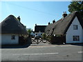
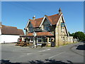
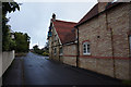
Thatched cottage on the High Street, Roxton
Image: © Alexander P Kapp
Taken: 24 Jul 2012
0.01 miles
2
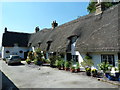
Thatched cottage on the High Street, Roxton
Image: © Alexander P Kapp
Taken: 24 Jul 2012
0.01 miles
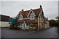
4
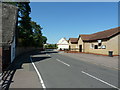
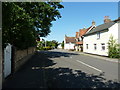
High Street, Roxton
With the village hall on the right
Image: © Alexander P Kapp
Taken: 24 Jul 2012
0.02 miles
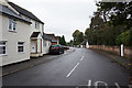
5
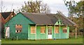
Pavilion
Playing golf on the playing field is forbidden!
Image: © Andrew Tatlow
Taken: 1 May 2006
0.02 miles