IMAGES TAKEN NEAR TO
Keysoe Row West, BEDFORD, MK44 2JF
Introduction
This page details the photographs taken nearby to Keysoe Row West, MK44 2JF by members of the Geograph project.
The Geograph project started in 2005 with the aim of publishing, organising and preserving representative images for every square kilometre of Great Britain, Ireland and the Isle of Man.

There are currently over 7.5m images from over14,400 individuals and you can help contribute to the project by visiting https://www.geograph.org.uk
Image Map
Images are licensed for reuse under creativecommons.org/licenses/by-sa/2.0
Notes
- Clicking on the map will re-center to the selected point.
- The higher the marker number, the further away the image location is from the centre of the postcode.
Image Listing (10 Images Found)
Images are licensed for reuse under creativecommons.org/licenses/by-sa/2.0
Image
Details
Distance
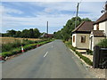
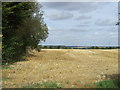
3
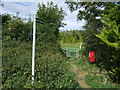
Footpath to Keysoe
Off Keysoe Row West footpath to Keysoe
Image: © Shaun Ferguson
Taken: 4 Sep 2009
0.13 miles
5
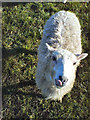
Shetland Sheep in Keysoe
Young male Shetland sheep born 1st May 2006 grazing in Keysoe
Image: © Gary and Caroline Kidd
Taken: 11 Feb 2007
0.16 miles
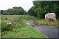
7
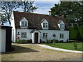
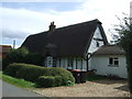
Rose Cottage Farm house, Hatch End, Keysoe Hatch End
Image: © JThomas
Taken: 13 Sep 2012
0.17 miles
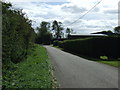
9
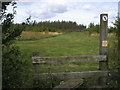
Bridleway and footpath off the Thurleigh road
Image: © Shaun Ferguson
Taken: 12 Jul 2007
0.21 miles