IMAGES TAKEN NEAR TO
Colmworth Road, MK44 2FG
Introduction
This page details the photographs taken nearby to Colmworth Road, MK44 2FG by members of the Geograph project.
The Geograph project started in 2005 with the aim of publishing, organising and preserving representative images for every square kilometre of Great Britain, Ireland and the Isle of Man.

There are currently over 7.5m images from over14,400 individuals and you can help contribute to the project by visiting https://www.geograph.org.uk
Image Map
Images are licensed for reuse under creativecommons.org/licenses/by-sa/2.0
Notes
- Clicking on the map will re-center to the selected point.
- The higher the marker number, the further away the image location is from the centre of the postcode.
Image Listing (11 Images Found)
Images are licensed for reuse under creativecommons.org/licenses/by-sa/2.0
Image
Details
Distance
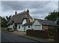
1
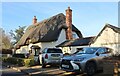
Thatched house on Colmworth Road, Little Staughton
Image: © David Howard
Taken: 19 Feb 2023
0.04 miles
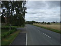
2
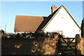
House on Colmworth Road, Little Staughton
Image: © David Howard
Taken: 19 Feb 2023
0.04 miles
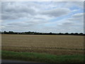
7
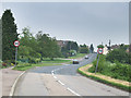
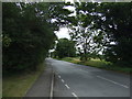
Little Staughton.
Picture showing the road entering the small village of Little Staughton.
Image: © Mike Fowkes
Taken: 13 May 2006
0.17 miles
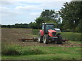
8
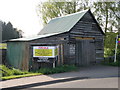
Another shed under threat, Little Staughton
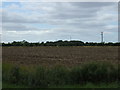
Potential development site in Little Staughton.
Image: © Michael Trolove
Taken: 24 Apr 2009
0.17 miles