IMAGES TAKEN NEAR TO
Riseley Road, BEDFORD, MK44 1QU
Introduction
This page details the photographs taken nearby to Riseley Road, MK44 1QU by members of the Geograph project.
The Geograph project started in 2005 with the aim of publishing, organising and preserving representative images for every square kilometre of Great Britain, Ireland and the Isle of Man.

There are currently over 7.5m images from over14,400 individuals and you can help contribute to the project by visiting https://www.geograph.org.uk
Image Map
Images are licensed for reuse under creativecommons.org/licenses/by-sa/2.0
Notes
- Clicking on the map will re-center to the selected point.
- The higher the marker number, the further away the image location is from the centre of the postcode.
Image Listing (6 Images Found)
Images are licensed for reuse under creativecommons.org/licenses/by-sa/2.0
Image
Details
Distance
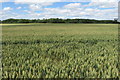
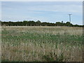
2
Bridleway heading towards Thurleigh airfield
The bridleway by Red House farm heads alongside Galsey woods towards Thurleigh airfield
Image: © Shaun Ferguson
Taken: 19 Jun 2007
0.16 miles
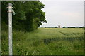
4
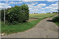
Public bridleway to Park Farm
Not a Pub as the finger post suggests
Image: © Philip Jeffrey
Taken: 5 Jul 2020
0.22 miles
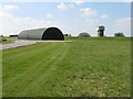
6
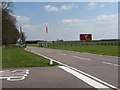
Bedford Autodrome at Thurleigh Airfield
The entrance to the Autodrome at Thurleigh.
Image: © M J Richardson
Taken: 22 Apr 2010
0.23 miles