IMAGES TAKEN NEAR TO
Colworth Estate, BEDFORD, MK44 1LD
Introduction
This page details the photographs taken nearby to Colworth Estate, MK44 1LD by members of the Geograph project.
The Geograph project started in 2005 with the aim of publishing, organising and preserving representative images for every square kilometre of Great Britain, Ireland and the Isle of Man.

There are currently over 7.5m images from over14,400 individuals and you can help contribute to the project by visiting https://www.geograph.org.uk
Image Map
Images are licensed for reuse under creativecommons.org/licenses/by-sa/2.0
Notes
- Clicking on the map will re-center to the selected point.
- The higher the marker number, the further away the image location is from the centre of the postcode.
Image Listing (10 Images Found)
Images are licensed for reuse under creativecommons.org/licenses/by-sa/2.0
Image
Details
Distance
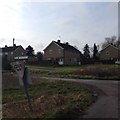
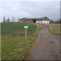
2
Sign listing the locations accessible from this junction
Image: © Dave Thompson
Taken: 14 Jan 2019
0.09 miles
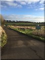
8
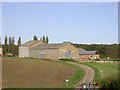
Lee Farm
On the Colworth Estate and owned by Unilever, a multinational company.
Image: © Kokai
Taken: 29 Oct 2006
0.18 miles