IMAGES TAKEN NEAR TO
High Street, BEDFORD, MK44 1DJ
Introduction
This page details the photographs taken nearby to High Street, MK44 1DJ by members of the Geograph project.
The Geograph project started in 2005 with the aim of publishing, organising and preserving representative images for every square kilometre of Great Britain, Ireland and the Isle of Man.

There are currently over 7.5m images from over14,400 individuals and you can help contribute to the project by visiting https://www.geograph.org.uk
Image Map
Images are licensed for reuse under creativecommons.org/licenses/by-sa/2.0
Notes
- Clicking on the map will re-center to the selected point.
- The higher the marker number, the further away the image location is from the centre of the postcode.
Image Listing (11 Images Found)
Images are licensed for reuse under creativecommons.org/licenses/by-sa/2.0
Image
Details
Distance
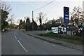
1
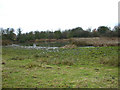
Disused Clay Quarry
On the site where the brickworks stood.
Image: © Kokai
Taken: 1 Jan 2006
0.06 miles
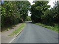
5
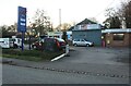
Petrol station on High Street, Riseley
This was UK petrol and a Daihatsu dealer before they pulled out of the UK.
Image: © David Howard
Taken: 19 Feb 2023
0.21 miles
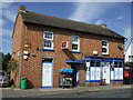
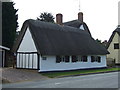
9
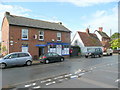
Riseley village stores
The village is not small, but there does not seem to be a post office here, despite the letter box.
Image: © Jonathan Billinger
Taken: 27 Jul 2009
0.23 miles
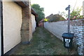
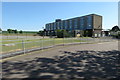
10
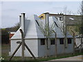
Faces through the wire fence
Curious structures near Riseley until you turn them over, they become hoppers of some description.
Image: © Michael Trolove
Taken: 10 Apr 2010
0.24 miles