IMAGES TAKEN NEAR TO
Knotting Road, BEDFORD, MK44 1BN
Introduction
This page details the photographs taken nearby to Knotting Road, MK44 1BN by members of the Geograph project.
The Geograph project started in 2005 with the aim of publishing, organising and preserving representative images for every square kilometre of Great Britain, Ireland and the Isle of Man.

There are currently over 7.5m images from over14,400 individuals and you can help contribute to the project by visiting https://www.geograph.org.uk
Image Map
Images are licensed for reuse under creativecommons.org/licenses/by-sa/2.0
Notes
- Clicking on the map will re-center to the selected point.
- The higher the marker number, the further away the image location is from the centre of the postcode.
Image Listing (6 Images Found)
Images are licensed for reuse under creativecommons.org/licenses/by-sa/2.0
Image
Details
Distance
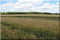
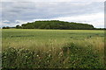
3
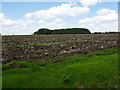
Ploughed field and woodland near Melchbourne
Image: © Jonathan Thacker
Taken: 17 Aug 2023
0.19 miles
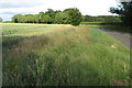
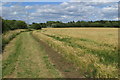
4
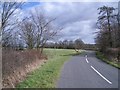
The Three Shire Bridleway near Knotting
The Three Shire Bridleway, a national route that extends from Milton Keynes to Grafham Water, traverses this country road for about a mile near Knotting and then turns sharp left at this point by the signpost to head northwards across country once again.
Image: © Nigel Stickells
Taken: 7 Mar 2007
0.20 miles