IMAGES TAKEN NEAR TO
Folkes Road, BEDFORD, MK43 9TE
Introduction
This page details the photographs taken nearby to Folkes Road, MK43 9TE by members of the Geograph project.
The Geograph project started in 2005 with the aim of publishing, organising and preserving representative images for every square kilometre of Great Britain, Ireland and the Isle of Man.

There are currently over 7.5m images from over14,400 individuals and you can help contribute to the project by visiting https://www.geograph.org.uk
Image Map (Loading...)


Getting Data...Please wait
Leaflet Map data © OpenStreetMap
Images are licensed for reuse under creativecommons.org/licenses/by-sa/2.0
Notes
- Clicking on the map will re-center to the selected point.
- The higher the marker number, the further away the image location is from the centre of the postcode.
Image Listing (15 Images Found)
Images are licensed for reuse under creativecommons.org/licenses/by-sa/2.0
Image
Details
Distance
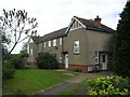
1
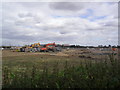
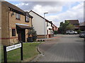
Wootton
Development near Wootton. Was like this; Image
Image: © Burgess Von Thunen
Taken: 14 Sep 2012
0.12 miles
2
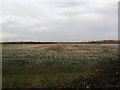
Farmland near Wootton
A field of stubble.
Image: © Burgess Von Thunen
Taken: 24 Nov 2011
0.12 miles
4
Stewart Court
1990s houses in Wootton.
Image: © Burgess Von Thunen
Taken: 14 Sep 2012
0.16 miles
5
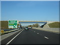
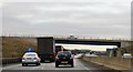
A421 passing under Fields Road
A new stretch of road opened December 2010.
Image: © Mr Ignavy
Taken: 28 Oct 2011
0.16 miles
6
Haycroft
1990s houses in Wootton.
Image: © Burgess Von Thunen
Taken: 14 Sep 2012
0.17 miles
7
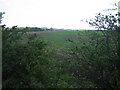
A421
Looking across A421 towards Brogborough tip
Image: © Marcus de Figueiredo
Taken: 19 Apr 2007
0.17 miles
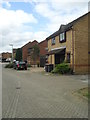
8

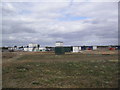
Fields Road
On the edge of Wootton.
Image: © Burgess Von Thunen
Taken: 18 Feb 2013
0.17 miles
9
Wootton
1930s maisonettes on the corner of Fields Road and Haycroft.
Image: © Burgess Von Thunen
Taken: 14 Sep 2012
0.20 miles