IMAGES TAKEN NEAR TO
Fields Road, BEDFORD, MK43 9JJ
Introduction
This page details the photographs taken nearby to Fields Road, MK43 9JJ by members of the Geograph project.
The Geograph project started in 2005 with the aim of publishing, organising and preserving representative images for every square kilometre of Great Britain, Ireland and the Isle of Man.

There are currently over 7.5m images from over14,400 individuals and you can help contribute to the project by visiting https://www.geograph.org.uk
Image Map
Images are licensed for reuse under creativecommons.org/licenses/by-sa/2.0
Notes
- Clicking on the map will re-center to the selected point.
- The higher the marker number, the further away the image location is from the centre of the postcode.
Image Listing (13 Images Found)
Images are licensed for reuse under creativecommons.org/licenses/by-sa/2.0
Image
Details
Distance
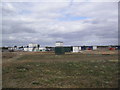
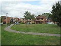
1
Summerfield Drive
2000s houses in Wootton.
Image: © Burgess Von Thunen
Taken: 14 Sep 2012
0.07 miles
2
Beauchamp Road
1970s semis in Wootton.
Image: © Burgess Von Thunen
Taken: 14 Sep 2012
0.08 miles
3
Cranfield Road, Wootton
Cranfield Road approaching the village of Wootton in Bedfordshire.
Image: © Malc McDonald
Taken: 20 Oct 2012
0.13 miles
4
Grovebury Court
1990s houses in Wootton.
Image: © Burgess Von Thunen
Taken: 14 Sep 2012
0.14 miles
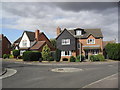
5
Cranfield Road at the junction of Church Road
Image: © David Howard
Taken: 12 Mar 2017
0.14 miles
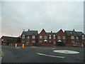
6
Wootton
1930s maisonettes on the corner of Fields Road and Haycroft.
Image: © Burgess Von Thunen
Taken: 14 Sep 2012
0.15 miles
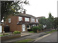
7
Stewart Court
1990s houses in Wootton.
Image: © Burgess Von Thunen
Taken: 14 Sep 2012
0.18 miles
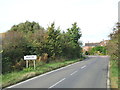
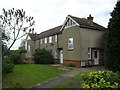
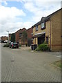
8

Fields Road
On the edge of Wootton.
Image: © Burgess Von Thunen
Taken: 18 Feb 2013
0.18 miles
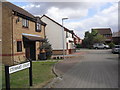
9
Haycroft
1990s houses in Wootton.
Image: © Burgess Von Thunen
Taken: 14 Sep 2012
0.18 miles