IMAGES TAKEN NEAR TO
Village Road, BEDFORD, MK43 8HX
Introduction
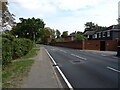
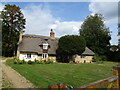
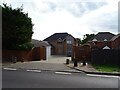
This page details the photographs taken nearby to Village Road, MK43 8HX by members of the Geograph project.
The Geograph project started in 2005 with the aim of publishing, organising and preserving representative images for every square kilometre of Great Britain, Ireland and the Isle of Man.

There are currently over 7.5m images from over14,400 individuals and you can help contribute to the project by visiting https://www.geograph.org.uk
Image Map
Images are licensed for reuse under creativecommons.org/licenses/by-sa/2.0
Notes
- Clicking on the map will re-center to the selected point.
- The higher the marker number, the further away the image location is from the centre of the postcode.
Image Listing (17 Images Found)
Images are licensed for reuse under creativecommons.org/licenses/by-sa/2.0
Image
Details
Distance
2

Elizabeth II postbox on Village Road
Postbox No. MK43 41.
Image: © JThomas
Taken: 21 Sep 2022
0.10 miles
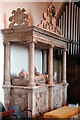
6
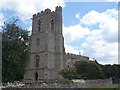
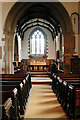
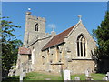
St Owen's church, Bromham
Mostly from the C13-C15 but with C19 and C20 repair and additions
Image: © Bikeboy
Taken: 27 Jun 2015
0.14 miles