IMAGES TAKEN NEAR TO
The Glade, BEDFORD, MK43 8HJ
Introduction
This page details the photographs taken nearby to The Glade, MK43 8HJ by members of the Geograph project.
The Geograph project started in 2005 with the aim of publishing, organising and preserving representative images for every square kilometre of Great Britain, Ireland and the Isle of Man.

There are currently over 7.5m images from over14,400 individuals and you can help contribute to the project by visiting https://www.geograph.org.uk
Image Map
Images are licensed for reuse under creativecommons.org/licenses/by-sa/2.0
Notes
- Clicking on the map will re-center to the selected point.
- The higher the marker number, the further away the image location is from the centre of the postcode.
Image Listing (8 Images Found)
Images are licensed for reuse under creativecommons.org/licenses/by-sa/2.0
Image
Details
Distance
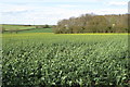
4
Hill above the houses
Looking down at the top of East Lodge and West Lodge, from the hill above Bromham
Image: © Oliver White
Taken: 29 Nov 2005
0.16 miles

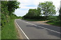
7
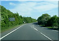
A428 Northampton Road at the Bromham turn
Image: © Colin Pyle
Taken: 13 May 2022
0.21 miles