IMAGES TAKEN NEAR TO
Church Lane, BEDFORD, MK43 7AA
Introduction
This page details the photographs taken nearby to Church Lane, MK43 7AA by members of the Geograph project.
The Geograph project started in 2005 with the aim of publishing, organising and preserving representative images for every square kilometre of Great Britain, Ireland and the Isle of Man.

There are currently over 7.5m images from over14,400 individuals and you can help contribute to the project by visiting https://www.geograph.org.uk
Image Map
Images are licensed for reuse under creativecommons.org/licenses/by-sa/2.0
Notes
- Clicking on the map will re-center to the selected point.
- The higher the marker number, the further away the image location is from the centre of the postcode.
Image Listing (36 Images Found)
Images are licensed for reuse under creativecommons.org/licenses/by-sa/2.0
Image
Details
Distance
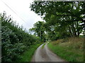
4
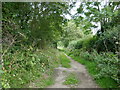
Bridleway to Sharnbrook
Part of the Ouse Valley Way.
Image: © Jonathan Thacker
Taken: 16 Aug 2023
0.16 miles
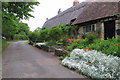
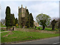
6
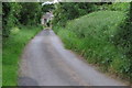
Church Lane
With the church at the end of it
Image: © Philip Jeffrey
Taken: 2 Jun 2019
0.19 miles
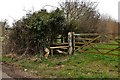
7
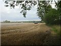
Waiting to collect
A tractor and trailer wait to offload wheat from a combine harvester.
Image: © Jonathan Thacker
Taken: 16 Aug 2023
0.20 miles
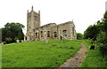
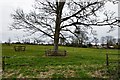
9
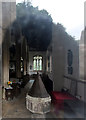
All Saints, Odell - Interior through a window
Image: © John Salmon
Taken: 3 Jun 2016
0.21 miles