IMAGES TAKEN NEAR TO
Cobblers Lane, BEDFORD, MK43 0XN
Introduction
This page details the photographs taken nearby to Cobblers Lane, MK43 0XN by members of the Geograph project.
The Geograph project started in 2005 with the aim of publishing, organising and preserving representative images for every square kilometre of Great Britain, Ireland and the Isle of Man.

There are currently over 7.5m images from over14,400 individuals and you can help contribute to the project by visiting https://www.geograph.org.uk
Image Map
Images are licensed for reuse under creativecommons.org/licenses/by-sa/2.0
Notes
- Clicking on the map will re-center to the selected point.
- The higher the marker number, the further away the image location is from the centre of the postcode.
Image Listing (10 Images Found)
Images are licensed for reuse under creativecommons.org/licenses/by-sa/2.0
Image
Details
Distance
1
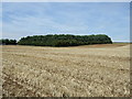
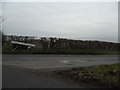
Woodland near Hope Farm
From Cobblers Lane.
Image: © JThomas
Taken: 22 Aug 2015
0.04 miles
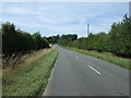
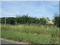
6
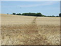
Footpath over stubble field
Off Cobblers Lane.
Image: © JThomas
Taken: 22 Aug 2015
0.13 miles
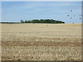
7
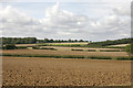
Arable fields south-west of Ridgmont
Taken from the Greensand Ridge Walk footpath. The building on the brow of the hill is Hollyhock Lodge.
Image: © David Kemp
Taken: 5 Sep 2009
0.18 miles
9
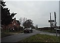
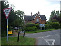
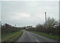
Eversholt Road at the junction of Cobblers Lane
Image: © David Howard
Taken: 12 Mar 2017
0.21 miles