IMAGES TAKEN NEAR TO
Bedford Road, BEDFORD, MK43 0UT
Introduction
This page details the photographs taken nearby to Bedford Road, MK43 0UT by members of the Geograph project.
The Geograph project started in 2005 with the aim of publishing, organising and preserving representative images for every square kilometre of Great Britain, Ireland and the Isle of Man.

There are currently over 7.5m images from over14,400 individuals and you can help contribute to the project by visiting https://www.geograph.org.uk
Image Map
Images are licensed for reuse under creativecommons.org/licenses/by-sa/2.0
Notes
- Clicking on the map will re-center to the selected point.
- The higher the marker number, the further away the image location is from the centre of the postcode.
Image Listing (11 Images Found)
Images are licensed for reuse under creativecommons.org/licenses/by-sa/2.0
Image
Details
Distance
1
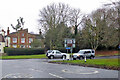
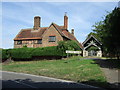
Road junction, Husborne Crawley
School Lane leaves Bedford Road. The large house is 'The Lodge', a grade II listed building, mid 19th century.
Image: © Robin Webster
Taken: 5 Dec 2021
0.08 miles
3

Road junction on School Lane, Husborne Crawley
Image: © JThomas
Taken: 22 Aug 2015
0.08 miles
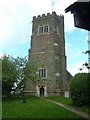
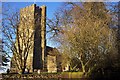
7
Lych gate, St James' Church, Husborne Crawley
Image: © JThomas
Taken: 22 Aug 2015
0.11 miles
10
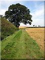
Oak tree by the path to Ridgmont station
Image: © Philip Jeffrey
Taken: 6 Sep 2012
0.17 miles