IMAGES TAKEN NEAR TO
Ampthill Road, BEDFORD, MK43 0RB
Introduction
This page details the photographs taken nearby to Ampthill Road, MK43 0RB by members of the Geograph project.
The Geograph project started in 2005 with the aim of publishing, organising and preserving representative images for every square kilometre of Great Britain, Ireland and the Isle of Man.

There are currently over 7.5m images from over14,400 individuals and you can help contribute to the project by visiting https://www.geograph.org.uk
Image Map
Images are licensed for reuse under creativecommons.org/licenses/by-sa/2.0
Notes
- Clicking on the map will re-center to the selected point.
- The higher the marker number, the further away the image location is from the centre of the postcode.
Image Listing (8 Images Found)
Images are licensed for reuse under creativecommons.org/licenses/by-sa/2.0
Image
Details
Distance
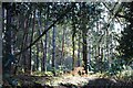
4
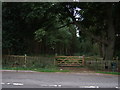
Track into woodland, Moneypot Hill
Off Woburn Road (A507).
Image: © JThomas
Taken: 22 Aug 2015
0.16 miles
7
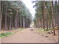
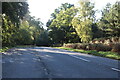
Path View
The view at Center Parcs' Woburn Forest in Bedfordshire.
Image: © Gordon Griffiths
Taken: 15 Nov 2018
0.24 miles
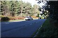
8
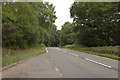
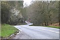
Woburn Road (A507)
Heading north east towards Ampthill.
Image: © JThomas
Taken: 22 Aug 2015
0.24 miles