IMAGES TAKEN NEAR TO
Greenview Close, BEDFORD, MK42 7BG
Introduction
This page details the photographs taken nearby to Greenview Close, MK42 7BG by members of the Geograph project.
The Geograph project started in 2005 with the aim of publishing, organising and preserving representative images for every square kilometre of Great Britain, Ireland and the Isle of Man.

There are currently over 7.5m images from over14,400 individuals and you can help contribute to the project by visiting https://www.geograph.org.uk
Image Map
Images are licensed for reuse under creativecommons.org/licenses/by-sa/2.0
Notes
- Clicking on the map will re-center to the selected point.
- The higher the marker number, the further away the image location is from the centre of the postcode.
Image Listing (30 Images Found)
Images are licensed for reuse under creativecommons.org/licenses/by-sa/2.0
Image
Details
Distance
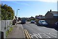
3
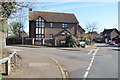
Meadowview Road, Kempston
View from Riverview Way.
Image: © N Avery
Taken: 24 Jan 2022
0.06 miles
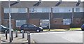
8
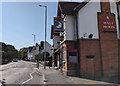
The Half Moon Inn on High Street in Kempston
Image: © Rob Purvis
Taken: 13 Sep 2020
0.09 miles
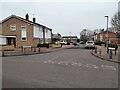
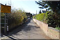
9
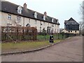
Mill Lane, Kempston
Houses on Mill Lane facing River Great Ouse.
Image: © N Avery
Taken: 24 Jan 2022
0.11 miles
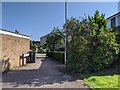
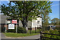
10
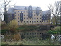
Housing development on the site of Kempston Mill
A recently constructed block of 'luxury apartments' on the former site of Kempston Mill.
Image: © Robert Kerr
Taken: 10 Nov 2011
0.12 miles