IMAGES TAKEN NEAR TO
Hockliffe Road, BEDFORD, MK42 0DY
Introduction
This page details the photographs taken nearby to Hockliffe Road, MK42 0DY by members of the Geograph project.
The Geograph project started in 2005 with the aim of publishing, organising and preserving representative images for every square kilometre of Great Britain, Ireland and the Isle of Man.

There are currently over 7.5m images from over14,400 individuals and you can help contribute to the project by visiting https://www.geograph.org.uk
Image Map
Images are licensed for reuse under creativecommons.org/licenses/by-sa/2.0
Notes
- Clicking on the map will re-center to the selected point.
- The higher the marker number, the further away the image location is from the centre of the postcode.
Image Listing (21 Images Found)
Images are licensed for reuse under creativecommons.org/licenses/by-sa/2.0
Image
Details
Distance
1
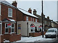
Converted public house, 'The Bricklayers Arms' Fenlake Road, Bedford
I am not sure when this pub closed for the last time, however this article in the local paper indicates that it was open in December 2008. http://www.bedfordtoday.co.uk/news/local/new_landlady_at_bricklayers_arms_1_1123541 This picture taken two years later shows it converted.
Image: © PAUL FARMER
Taken: 26 Dec 2010
0.04 miles
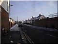
2
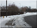
Railway Sleepers forming barrier between Fenlake Road and Cardington Road, Bedford
Image: © PAUL FARMER
Taken: 26 Dec 2010
0.08 miles
5
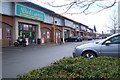
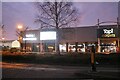
St Johns Retail Park
Perhaps places like this have caused the death of the High Street store.
Image: © Dennis simpson
Taken: 10 Mar 2008
0.16 miles
6
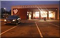
Costa in St Johns Retail Park, Bedford
Image: © David Howard
Taken: 30 Jan 2022
0.17 miles
7
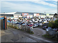
Course of old railway and retail park, Bedford
The smaller private car park accessed through an open gate is on the course of the Bletchley - Cambridge line, cut back to Bedford for passenger services in 1967, although there appears to have been freight use of the line here, but only as far as Goldington power station. That closed in 1983.
On the extreme left is a washer at the Stagecoach bus garage, and presumably the private car park is for employees here. The retail park is on an old industrial site.
Image: © Robin Webster
Taken: 9 Dec 2017
0.18 miles
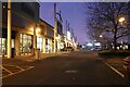
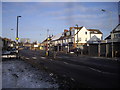
8
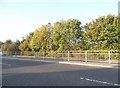
Fenlake Road, Bedford
Taken from the junction with London Road
Image: © PAUL FARMER
Taken: 25 Dec 2010
0.19 miles
9
Pedestrian Crossing, London Road, Bedford
Image: © PAUL FARMER
Taken: 25 Dec 2010
0.20 miles