IMAGES TAKEN NEAR TO
Wheathouse Close, BEDFORD, MK41 8JY
Introduction
This page details the photographs taken nearby to Wheathouse Close, MK41 8JY by members of the Geograph project.
The Geograph project started in 2005 with the aim of publishing, organising and preserving representative images for every square kilometre of Great Britain, Ireland and the Isle of Man.

There are currently over 7.5m images from over14,400 individuals and you can help contribute to the project by visiting https://www.geograph.org.uk
Image Map
Images are licensed for reuse under creativecommons.org/licenses/by-sa/2.0
Notes
- Clicking on the map will re-center to the selected point.
- The higher the marker number, the further away the image location is from the centre of the postcode.
Image Listing (16 Images Found)
Images are licensed for reuse under creativecommons.org/licenses/by-sa/2.0
Image
Details
Distance
2
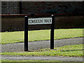
Somerton Walk sign
On Somerton Walk at the junction with Wentworth Drive
Image: © Geographer
Taken: 9 Aug 2014
0.22 miles
3
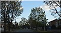
Somerton Walk, Woodside
At the junction with Wentworth Drive
Image: © Geographer
Taken: 9 Aug 2014
0.22 miles
4
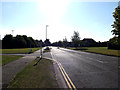
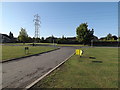
Wentworth Drive, Woodside
At the entrance to Bedford Athletic RUFC
Image: © Geographer
Taken: 9 Aug 2014
0.23 miles
5
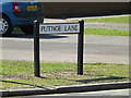
Putnoe Lane sign
On Putnoe Lane at the junction with Wentworth Drive
Image: © Geographer
Taken: 8 Aug 2015
0.23 miles
7
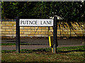
Putnoe Lane sign
On Putnoe Lane at the junction with Wentworth Drive
Image: © Geographer
Taken: 9 Aug 2014
0.24 miles
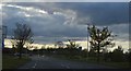
8
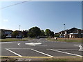
Putnoe Lane, Woodside
At the junction with Wentworth Drive
Image: © Geographer
Taken: 9 Aug 2014
0.24 miles
9
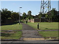
Entrance of Bedford Athletic RUFC
Looking towards Wentworth Drive
Image: © Geographer
Taken: 9 Aug 2014
0.24 miles
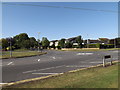
10
Putnoe Lane, Salph End
At the junction with Wentworth Drive
Image: © Geographer
Taken: 8 Aug 2015
0.24 miles