IMAGES TAKEN NEAR TO
Tyne Crescent, BEDFORD, MK41 7UL
Introduction
This page details the photographs taken nearby to Tyne Crescent, MK41 7UL by members of the Geograph project.
The Geograph project started in 2005 with the aim of publishing, organising and preserving representative images for every square kilometre of Great Britain, Ireland and the Isle of Man.

There are currently over 7.5m images from over14,400 individuals and you can help contribute to the project by visiting https://www.geograph.org.uk
Image Map
Images are licensed for reuse under creativecommons.org/licenses/by-sa/2.0
Notes
- Clicking on the map will re-center to the selected point.
- The higher the marker number, the further away the image location is from the centre of the postcode.
Image Listing (6 Images Found)
Images are licensed for reuse under creativecommons.org/licenses/by-sa/2.0
Image
Details
Distance
1
St Mark's Church community centre
St Mark's Church community centre on Calder rise
Image: © Shaun Ferguson
Taken: 12 Jul 2007
0.12 miles
2
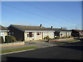
Torridge Rise
1970s bungalows and electricity wires in Brickhill.
Image: © Burgess Von Thunen
Taken: 21 Feb 2012
0.18 miles
3
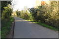
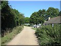
Clapham Park entrance
From Hawk Drive, on the northwestern outskirts of Bedford. A Bedfordshire farm woodland demonstration project.
Image: © M J Richardson
Taken: 21 Sep 2017
0.21 miles
5
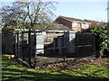
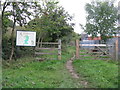
Brickhill
Electrical equipment behind Helford Close.
Image: © Burgess Von Thunen
Taken: 21 Feb 2012
0.23 miles